Gouy-Saint-André geodata
Gouy-Saint-André (Hauts-de-France) is a populated place; located in France in Europe/Paris (GMT+2) time zone. With population of 614 people, there are 13088 cities with bigger population in this country. Compared to other cities in France, 96.2% of cities are located further ↓South; 58.3% of cities are located further →East and 61.5% of cities have higher elevation than Gouy-Saint-André. Note1
Administrative division(s):
- Level 1: Hauts-de-France
- Level 2: Pas-de-Calais
- Level 3: Arrondissement de Montreuil
- Level 4: Gouy-Saint-André


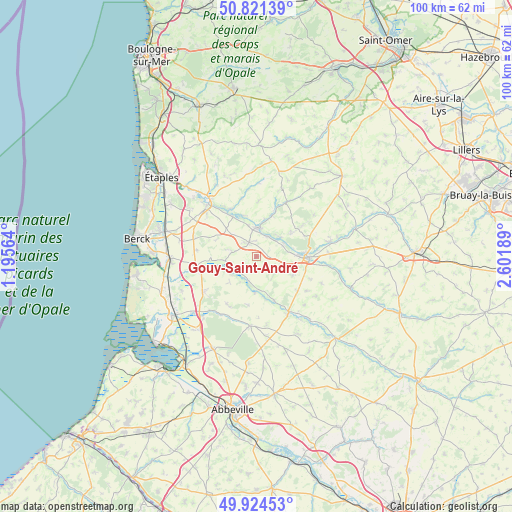
Gouy-Saint-André GPS coordinates[2]
50° 22' 30.288" North, 1° 53' 55.536" East
| Map corner | latitude | longitude |
|---|---|---|
| Upper-left | 50.82139°, | 1.19564° |
| Center: | 50.37508°, | 1.89876° |
| Lower-right: | 49.92453°, | 2.60189° |
| Map W x H: | 99.7×99.7 km | = 62×62mi |
| max Lat: | 51.07786° ⇑3.8% North |
| Gouy-Saint-André: | 50.37508° |
| min Lat: | ⇓96.2% South 41.3874° |
| min Long | Gouy-Saint-Andr | max Long |
| -5.08615° | 1.89876° | 9.52242° |
| W 41.7%⇐ | ⇒58.3% E |
Elevation
Elevation of Gouy-Saint-André is 98 m = 322 ft, and this is 95.7 m = 314 ft below average elevation for this country.
| Max E: |
2333 m = 7654 ft | 61.5% |
| Avg. | 193.7 m = 635 ft | |
| Gouy-Saint-André | 98 m = 322 ft | |
Min E: |
-1 m = -3 ft | 38.5% |
See also: France elevation on elevation.city.
Geographical zone
Gouy-Saint-André is located in North temperate zone (between Tropic of Cancer and the Arctic Circle). Distance of this North polar circle is 1800 km =1118.5 mi to North.| Distance of | km | miles | from Gouy-Saint-André |
|---|---|---|---|
| North Pole | 4405.9 | 2737.7 | to North |
| Arctic Circle | 1800 | 1118.5 | to North |
| Tropic Cancer | 2995.3 | 1861.2 | to South |
| Equator | 5601.2 | 3480.4 | to South |


Nearby cities:
15 places around Gouy-Saint-André: (largest is in red/bold)
• Aubin-Saint-Vaast
5.7 km =3.5 mi,  67°
67°
• Beaurainville
5.5 km =3.4 mi,  0°
0°
• Bouin-Plumoison
6.1 km =3.8 mi,  81°
81°
• Brimeux
8.9 km =5.5 mi,  329°
329°
• Buire-le-Sec
4.8 km =3 mi,  282°
282°
• Campagne-lès-Hesdin
3 km =1.9 mi, 325°
• Ecquemicourt
4.7 km =2.9 mi,  50°
50°
• Fressin
13.6 km =8.5 mi, 52°
• Hesdin
9.9 km =6.2 mi,  91°
91°
• Huby-Saint-Leu
9.9 km =6.2 mi, 85°
• Marconne
10.5 km =6.5 mi, 92°
• Marconnelle
8 km =5 mi, 89°
• Vron
12.2 km =7.6 mi,  236°
236°
• Wailly-Beaucamp
12.9 km =8 mi,  287°
287°
• Écuires
12.6 km =7.8 mi,  310°
310°
Sources, notices
• [Note1] Compared only with cities in France existing in our database
• [Src1] Map data: © OpenStreetMap contributors (CC-BY-SA)
• [Src2] Other city data from geonames.org with taken over terms of usage.
• [Src3] Geographical zone / Annual Mean Temperature by Robert A. Rohde @ Wikipedia
