Goult geodata
Goult (Provence-Alpes-Côte d'Azur) is a populated place; located in France in Europe/Paris (GMT+2) time zone. With population of 1,381 people, there are 6680 cities with bigger population in this country. Compared to other cities in France, 88.5% of cities are located further ↑North; 80.1% of cities are located further ←West and 69.6% of cities have lower elevation than Goult. Note1
Administrative division(s):
- Level 1: Provence-Alpes-Côte d'Azur
- Level 2: Département du Vaucluse
- Level 3: Apt
- Level 4: Goult


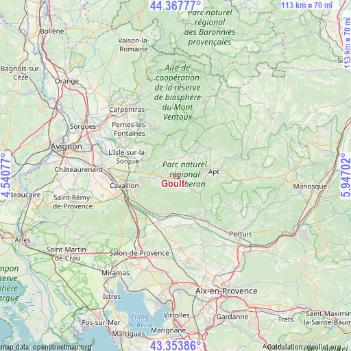
Goult GPS coordinates[2]
43° 51' 46.692" North, 5° 14' 38.04" East
| Map corner | latitude | longitude |
|---|---|---|
| Upper-left | 44.36777°, | 4.54077° |
| Center: | 43.86297°, | 5.2439° |
| Lower-right: | 43.35386°, | 5.94702° |
| Map W x H: | 112.7×112.7 km | = 70×70mi |
| max Lat: | 51.07786° ⇑88.5% North |
| Goult: | 43.86297° |
| min Lat: | ⇓11.5% South 41.3874° |
| min Long | Goult | max Long |
| -5.08615° | 5.2439° | 9.52242° |
| W 80.1%⇐ | ⇒19.9% E |
Elevation
Elevation of Goult is 217 m = 712 ft, and this is 23.3 m = 76 ft above average elevation for this country.
| Max E: |
2333 m = 7654 ft | 30.4% |
| Goult | 217 m 712 ft | |
| Avg. | 193.7 m = 635 ft | |
Min E: |
-1 m = -3 ft | 69.6% |
See also: France elevation on elevation.city.
Geographical zone
Goult is located in North temperate zone (between Tropic of Cancer and the Arctic Circle). Distance of this Northern Tropic circle is 2271.2 km =1411.3 mi to South.| Distance of | km | miles | from Goult |
|---|---|---|---|
| North Pole | 5130 | 3187.6 | to North |
| Arctic Circle | 2524.1 | 1568.4 | to North |
| Tropic Cancer | 2271.2 | 1411.3 | to South |
| Equator | 4877.1 | 3030.5 | to South |


Nearby cities:
15 places around Goult: (largest is in red/bold)
• Apt
12.3 km =7.6 mi,  83°
83°
• Bonnieux
6.7 km =4.2 mi,  130°
130°
• Fontaine-de-Vaucluse
11.5 km =7.1 mi,  305°
305°
• Gargas
10.1 km =6.3 mi,  64°
64°
• Gordes
6.6 km =4.1 mi,  327°
327°
• Lagnes
10.9 km =6.8 mi,  288°
288°
• Maubec
8.7 km =5.4 mi,  255°
255°
• Ménerbes
4.6 km =2.9 mi,  221°
221°
• Mérindol
12.4 km =7.7 mi,  195°
195°
• Oppède le Vieux
7.7 km =4.8 mi,  239°
239°
• Puget
12.2 km =7.6 mi,  170°
170°
• Robion
10.9 km =6.8 mi, 260°
• Roussillon
5.9 km =3.7 mi,  41°
41°
• Saint-Saturnin-lès-Apt
13.6 km =8.5 mi,  54°
54°
• Taillades
12.7 km =7.9 mi, 257°
Sources, notices
• [Note1] Compared only with cities in France existing in our database
• [Src1] Map data: © OpenStreetMap contributors (CC-BY-SA)
• [Src2] Other city data from geonames.org with taken over terms of usage.
• [Src3] Geographical zone / Annual Mean Temperature by Robert A. Rohde @ Wikipedia
