Saint-Saturnin-lès-Apt geodata
Saint-Saturnin-lès-Apt (Provence-Alpes-Côte d'Azur) is a populated place; located in France in Europe/Paris (GMT+2) time zone. With population of 2,523 people, there are 3868 cities with bigger population in this country. Compared to other cities in France, 87.7% of cities are located further ↑North; 81.6% of cities are located further ←West and 80.7% of cities have lower elevation than Saint-Saturnin-lès-Apt. Note1
Administrative division(s):
- Level 1: Provence-Alpes-Côte d'Azur
- Level 2: Département du Vaucluse
- Level 3: Apt
- Level 4: Saint-Saturnin-lès-Apt
Current local time in Saint-Saturnin-lès-Apt:
04:38 AM, WednesdayDifference from your time zone: hours


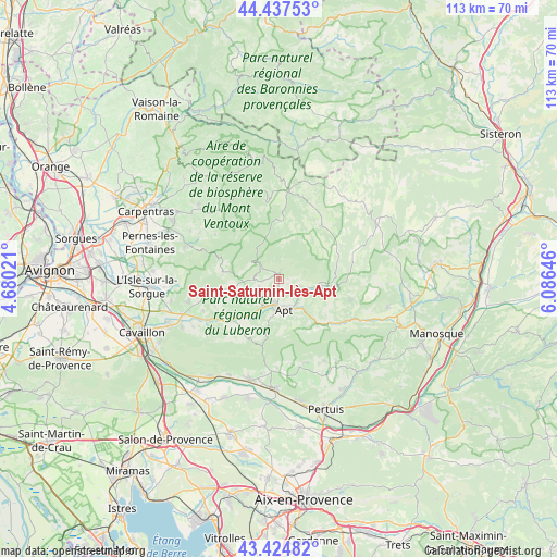
Saint-Saturnin-lès-Apt GPS coordinates[2]
43° 55' 59.988" North, 5° 22' 59.988" East
| Map corner | latitude | longitude |
|---|---|---|
| Upper-left | 44.43753°, | 4.68021° |
| Center: | 43.93333°, | 5.38333° |
| Lower-right: | 43.42482°, | 6.08646° |
| Map W x H: | 112.6×112.6 km | = 70×70mi |
| max Lat: | 51.07786° ⇑87.7% North |
| Saint-Saturnin-lès-Apt: | 43.93333° |
| min Lat: | ⇓12.3% South 41.3874° |
| min Long | Saint-Saturnin- | max Long |
| -5.08615° | 5.38333° | 9.52242° |
| W 81.6%⇐ | ⇒18.4% E |
Elevation
Elevation of Saint-Saturnin-lès-Apt is 298 m = 978 ft, and this is 104.3 m = 342 ft above average elevation for this country.
| Max E: |
2333 m = 7654 ft | 19.3% |
| Saint-Saturnin-lès-Apt | 298 m 978 ft | |
| Avg. | 193.7 m = 635 ft | |
Min E: |
-1 m = -3 ft | 80.7% |
See also: France elevation on elevation.city.
Geographical zone
Saint-Saturnin-lès-Apt is located in North temperate zone (between Tropic of Cancer and the Arctic Circle). Distance of this Northern Tropic circle is 2279 km =1416.1 mi to South.| Distance of | km | miles | from Saint-Saturnin-lès-Apt |
|---|---|---|---|
| North Pole | 5122.1 | 3182.7 | to North |
| Arctic Circle | 2516.2 | 1563.5 | to North |
| Tropic Cancer | 2279 | 1416.1 | to South |
| Equator | 4884.9 | 3035.3 | to South |


Nearby cities:
15 places around Saint-Saturnin-lès-Apt: (largest is in red/bold)
• Apt
6.4 km =4 mi,  170°
170°
• Bonnieux
13.6 km =8.5 mi,  206°
206°
• Gargas
4 km =2.5 mi, 210°
• Gordes
14.9 km =9.3 mi,  261°
261°
• Goult
13.6 km =8.5 mi,  234°
234°
• Ménerbes
18.1 km =11.2 mi, 231°
• Roussillon
8 km =5 mi,  244°
244°
• Rustrel
8.2 km =5.1 mi,  96°
96°
• Saignon
8.6 km =5.3 mi,  155°
155°
• Saint-Christol
13.7 km =8.5 mi,  39°
39°
• Saint-Martin-de-Castillon
13.1 km =8.1 mi,  128°
128°
• Sault
17.5 km =10.9 mi,  6°
6°
• Simiane-la-Rotonde
15.4 km =9.6 mi,  69°
69°
• Viens
15.2 km =9.4 mi,  106°
106°
• Villars
2.1 km =1.3 mi,  121°
121°
Sources, notices
• [Note1] Compared only with cities in France existing in our database
• [Src1] Map data: © OpenStreetMap contributors (CC-BY-SA)
• [Src2] Other city data from geonames.org with taken over terms of usage.
• [Src3] Geographical zone / Annual Mean Temperature by Robert A. Rohde @ Wikipedia
