Frœschwiller geodata
Frœschwiller (Grand Est) is a populated place; located in France in Europe/Paris (GMT+2) time zone. With population of 519 people, there are 14840 cities with bigger population in this country. Compared to other cities in France, 78.5% of cities are located further ↓South; 99.1% of cities are located further ←West and 69.4% of cities have lower elevation than Frœschwiller. Note1
Administrative division(s):
- Level 1: Grand Est
- Level 2: Bas-Rhin
- Level 3: Arrondissement de Haguenau-Wissembourg
- Level 4: Frœschwiller


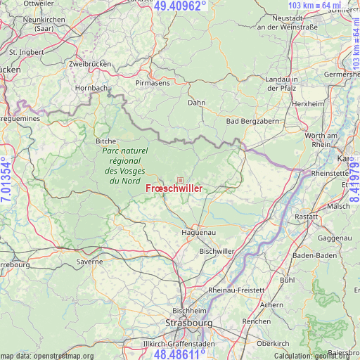
Frœschwiller GPS coordinates[2]
48° 57' 0" North, 7° 43' 0.012" East
| Map corner | latitude | longitude |
|---|---|---|
| Upper-left | 49.40962°, | 7.01354° |
| Center: | 48.95°, | 7.71667° |
| Lower-right: | 48.48611°, | 8.41979° |
| Map W x H: | 102.7×102.7 km | = 63.8×63.8mi |
| max Lat: | 51.07786° ⇑21.5% North |
| Frœschwiller: | 48.95° |
| min Lat: | ⇓78.5% South 41.3874° |
| min Long | Frœschwiller | max Long |
| -5.08615° | 7.71667° | 9.52242° |
| W 99.1%⇐ | ⇒0.90000000000001% E |
Elevation
Elevation of Frœschwiller is 216 m = 709 ft, and this is 22.3 m = 73 ft above average elevation for this country.
| Max E: |
2333 m = 7654 ft | 30.6% |
| Frœschwiller | 216 m 709 ft | |
| Avg. | 193.7 m = 635 ft | |
Min E: |
-1 m = -3 ft | 69.4% |
See also: France elevation on elevation.city.
Geographical zone
Frœschwiller is located in North temperate zone (between Tropic of Cancer and the Arctic Circle). Distance of this North polar circle is 1958.4 km =1216.9 mi to North.| Distance of | km | miles | from Frœschwiller |
|---|---|---|---|
| North Pole | 4564.3 | 2836.1 | to North |
| Arctic Circle | 1958.4 | 1216.9 | to North |
| Tropic Cancer | 2836.8 | 1762.7 | to South |
| Equator | 5442.7 | 3381.9 | to South |


Nearby cities:
15 places around Frœschwiller: (largest is in red/bold)
• Durrenbach
7 km =4.3 mi,  147°
147°
• Forstheim
6.1 km =3.8 mi,  181°
181°
• Gumbrechtshoffen
8.1 km =5 mi,  232°
232°
• Gundershoffen
6.3 km =3.9 mi,  220°
220°
• Gunstett
5.2 km =3.2 mi,  139°
139°
• Gœrsdorf
3.7 km =2.3 mi,  90°
90°
• Lampertsloch
7.3 km =4.5 mi,  83°
83°
• Langensoultzbach
2.3 km =1.4 mi,  33°
33°
• Lembach
8 km =5 mi,  41°
41°
• Morsbronn-les-Bains
5.7 km =3.5 mi,  159°
159°
• Niederbronn-les-Bains
5.4 km =3.4 mi,  271°
271°
• Oberbronn
8.1 km =5 mi,  262°
262°
• Preuschdorf
6.2 km =3.9 mi,  95°
95°
• Reichshoffen
4.2 km =2.6 mi,  242°
242°
• Woerth
2.2 km =1.4 mi,  121°
121°
Sources, notices
• [Note1] Compared only with cities in France existing in our database
• [Src1] Map data: © OpenStreetMap contributors (CC-BY-SA)
• [Src2] Other city data from geonames.org with taken over terms of usage.
• [Src3] Geographical zone / Annual Mean Temperature by Robert A. Rohde @ Wikipedia
