Gumbrechtshoffen geodata
Gumbrechtshoffen (Grand Est) is a populated place; located in France in Europe/Paris (GMT+2) time zone. With population of 1,299 people, there are 7036 cities with bigger population in this country. Compared to other cities in France, 77.7% of cities are located further ↓South; 98.7% of cities are located further ←West and 60.9% of cities have lower elevation than Gumbrechtshoffen. Note1
Administrative division(s):
- Level 1: Grand Est
- Level 2: Bas-Rhin
- Level 3: Arrondissement de Haguenau-Wissembourg
- Level 4: Gumbrechtshoffen


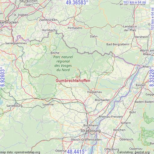
Gumbrechtshoffen GPS coordinates[2]
48° 54' 20.88" North, 7° 37' 44.94" East
| Map corner | latitude | longitude |
|---|---|---|
| Upper-left | 49.36583°, | 6.92603° |
| Center: | 48.9058°, | 7.62915° |
| Lower-right: | 48.4415°, | 8.33228° |
| Map W x H: | 102.8×102.8 km | = 63.9×63.9mi |
| max Lat: | 51.07786° ⇑22.3% North |
| Gumbrechtshoffen: | 48.9058° |
| min Lat: | ⇓77.7% South 41.3874° |
| min Long | Gumbrechtshoffe | max Long |
| -5.08615° | 7.62915° | 9.52242° |
| W 98.7%⇐ | ⇒1.3% E |
Elevation
Elevation of Gumbrechtshoffen is 174 m = 571 ft, and this is 19.7 m = 65 ft below average elevation for this country.
| Max E: |
2333 m = 7654 ft | 39.1% |
| Avg. | 193.7 m = 635 ft | |
| Gumbrechtshoffen | 174 m = 571 ft | |
Min E: |
-1 m = -3 ft | 60.9% |
See also: France elevation on elevation.city.
Geographical zone
Gumbrechtshoffen is located in North temperate zone (between Tropic of Cancer and the Arctic Circle). Distance of this North polar circle is 1963.4 km =1220 mi to North.| Distance of | km | miles | from Gumbrechtshoffen |
|---|---|---|---|
| North Pole | 4569.2 | 2839.2 | to North |
| Arctic Circle | 1963.4 | 1220 | to North |
| Tropic Cancer | 2831.9 | 1759.7 | to South |
| Equator | 5437.8 | 3378.9 | to South |


Nearby cities:
15 places around Gumbrechtshoffen: (largest is in red/bold)
• Forstheim
6.4 km =4 mi,  100°
100°
• Gundershoffen
2.3 km =1.4 mi,  88°
88°
• Kindwiller
5.4 km =3.4 mi,  206°
206°
• Mertzwiller
5.9 km =3.7 mi,  139°
139°
• Mietesheim
3.1 km =1.9 mi,  163°
163°
• Niederbronn-les-Bains
5.2 km =3.2 mi,  10°
10°
• Niedermodern
6.7 km =4.2 mi,  181°
181°
• Oberbronn
4.2 km =2.6 mi,  337°
337°
• Offwiller
6.2 km =3.9 mi,  275°
275°
• Pfaffenhoffen
7.3 km =4.5 mi,  192°
192°
• Reichshoffen
4 km =2.5 mi,  41°
41°
• Rothbach
7.3 km =4.5 mi,  271°
271°
• Uberach
6.2 km =3.9 mi, 179°
• Uhrwiller
4.9 km =3 mi,  230°
230°
• Zinswiller
3.3 km =2.1 mi,  298°
298°
Sources, notices
• [Note1] Compared only with cities in France existing in our database
• [Src1] Map data: © OpenStreetMap contributors (CC-BY-SA)
• [Src2] Other city data from geonames.org with taken over terms of usage.
• [Src3] Geographical zone / Annual Mean Temperature by Robert A. Rohde @ Wikipedia
