Reichshoffen geodata
Reichshoffen (Grand Est) is a populated place; located in France in Europe/Paris (GMT+2) time zone. With population of 5,539 people, there are 1788 cities with bigger population in this country. Compared to other cities in France, 78.2% of cities are located further ↓South; 98.9% of cities are located further ←West and 61% of cities have lower elevation than Reichshoffen. Note1
Administrative division(s):
- Level 1: Grand Est
- Level 2: Bas-Rhin
- Level 3: Arrondissement de Haguenau-Wissembourg
- Level 4: Reichshoffen


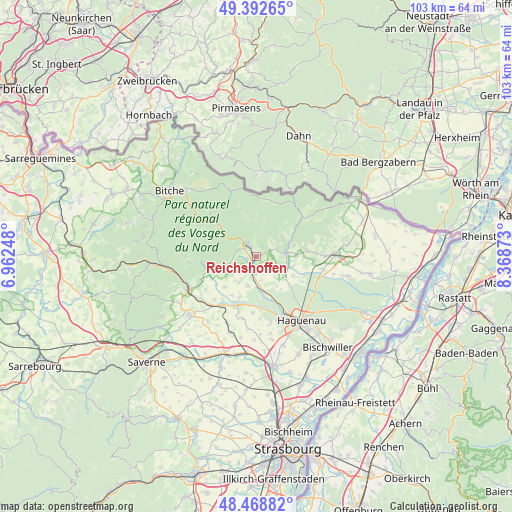
Reichshoffen GPS coordinates[2]
48° 55' 58.332" North, 7° 39' 56.196" East
| Map corner | latitude | longitude |
|---|---|---|
| Upper-left | 49.39265°, | 6.96248° |
| Center: | 48.93287°, | 7.66561° |
| Lower-right: | 48.46882°, | 8.36873° |
| Map W x H: | 102.7×102.7 km | = 63.8×63.8mi |
| max Lat: | 51.07786° ⇑21.8% North |
| Reichshoffen: | 48.93287° |
| min Lat: | ⇓78.2% South 41.3874° |
| min Long | Reichshoffen | max Long |
| -5.08615° | 7.66561° | 9.52242° |
| W 98.9%⇐ | ⇒1.1% E |
Elevation
Elevation of Reichshoffen is 175 m = 574 ft, and this is 18.7 m = 61 ft below average elevation for this country.
| Max E: |
2333 m = 7654 ft | 39% |
| Avg. | 193.7 m = 635 ft | |
| Reichshoffen | 175 m = 574 ft | |
Min E: |
-1 m = -3 ft | 61% |
See also: France elevation on elevation.city.
Geographical zone
Reichshoffen is located in North temperate zone (between Tropic of Cancer and the Arctic Circle). Distance of this North polar circle is 1960.3 km =1218.1 mi to North.| Distance of | km | miles | from Reichshoffen |
|---|---|---|---|
| North Pole | 4566.2 | 2837.3 | to North |
| Arctic Circle | 1960.3 | 1218.1 | to North |
| Tropic Cancer | 2834.9 | 1761.5 | to South |
| Equator | 5440.8 | 3380.8 | to South |


Nearby cities:
15 places around Reichshoffen: (largest is in red/bold)
• Eschbach
8.3 km =5.2 mi,  141°
141°
• Forstheim
5.6 km =3.5 mi, 139°
• Frœschwiller
4.2 km =2.6 mi,  62°
62°
• Gumbrechtshoffen
4 km =2.5 mi,  221°
221°
• Gundershoffen
3 km =1.9 mi,  186°
186°
• Gunstett
7.4 km =4.6 mi,  106°
106°
• Gœrsdorf
7.6 km =4.7 mi,  75°
75°
• Langensoultzbach
6.3 km =3.9 mi,  52°
52°
• Mertzwiller
7.6 km =4.7 mi,  171°
171°
• Mietesheim
6.3 km =3.9 mi,  196°
196°
• Morsbronn-les-Bains
6.7 km =4.2 mi,  121°
121°
• Niederbronn-les-Bains
2.7 km =1.7 mi,  321°
321°
• Oberbronn
4.4 km =2.7 mi,  280°
280°
• Woerth
5.7 km =3.5 mi, 82°
• Zinswiller
5.7 km =3.5 mi,  255°
255°
Sources, notices
• [Note1] Compared only with cities in France existing in our database
• [Src1] Map data: © OpenStreetMap contributors (CC-BY-SA)
• [Src2] Other city data from geonames.org with taken over terms of usage.
• [Src3] Geographical zone / Annual Mean Temperature by Robert A. Rohde @ Wikipedia
