Fretigney-et-Velloreille geodata
Fretigney-et-Velloreille (Bourgogne-Franche-Comté) is a populated place; located in France in Europe/Paris (GMT+2) time zone. With population of 640 people, there are 12673 cities with bigger population in this country. Compared to other cities in France, 51% of cities are located further ↓South; 86.3% of cities are located further ←West and 76.5% of cities have lower elevation than Fretigney-et-Velloreille. Note1
Administrative division(s):
- Level 1: Bourgogne-Franche-Comté
- Level 2: Département de la Haute-Saône
- Level 3: Arrondissement de Vesoul
- Level 4: Fretigney-et-Velloreille
Current local time in Fretigney-et-Velloreille:
05:54 AM, WednesdayDifference from your time zone: hours


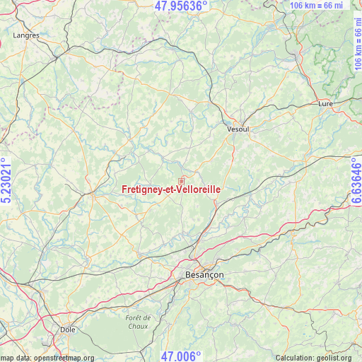
Fretigney-et-Velloreille GPS coordinates[2]
47° 28' 59.988" North, 5° 55' 59.988" East
| Map corner | latitude | longitude |
|---|---|---|
| Upper-left | 47.95636°, | 5.23021° |
| Center: | 47.48333°, | 5.93333° |
| Lower-right: | 47.006°, | 6.63646° |
| Map W x H: | 105.7×105.7 km | = 65.7×65.7mi |
| max Lat: | 51.07786° ⇑49% North |
| Fretigney-et-Velloreille: | 47.48333° |
| min Lat: | ⇓51% South 41.3874° |
| min Long | Fretigney-et-Ve | max Long |
| -5.08615° | 5.93333° | 9.52242° |
| W 86.3%⇐ | ⇒13.7% E |
Elevation
Elevation of Fretigney-et-Velloreille is 260 m = 853 ft, and this is 66.3 m = 218 ft above average elevation for this country.
| Max E: |
2333 m = 7654 ft | 23.5% |
| Fretigney-et-Velloreille | 260 m 853 ft | |
| Avg. | 193.7 m = 635 ft | |
Min E: |
-1 m = -3 ft | 76.5% |
See also: France elevation on elevation.city.
Geographical zone
Fretigney-et-Velloreille is located in North temperate zone (between Tropic of Cancer and the Arctic Circle). Distance of this North polar circle is 2121.5 km =1318.2 mi to North.| Distance of | km | miles | from Fretigney-et-Velloreille |
|---|---|---|---|
| North Pole | 4727.4 | 2937.5 | to North |
| Arctic Circle | 2121.5 | 1318.2 | to North |
| Tropic Cancer | 2673.7 | 1661.4 | to South |
| Equator | 5279.7 | 3280.7 | to South |


Nearby cities:
15 places around Fretigney-et-Velloreille: (largest is in red/bold)
• Beaujeu-Saint-Vallier-Pierrejux-et-Quitteur
18.9 km =11.7 mi,  275°
275°
• Bonnay
18.8 km =11.7 mi,  152°
152°
• Boult
12.4 km =7.7 mi,  155°
155°
• Bucey-lès-Gy
9.6 km =6 mi,  225°
225°
• Devecey
19.1 km =11.9 mi, 160°
• Fresne-Saint-Mamès
8.8 km =5.5 mi,  321°
321°
• Geneuille
18 km =11.2 mi,  171°
171°
• Gy
12.5 km =7.8 mi, 226°
• Mailley-et-Chazelot
10.8 km =6.7 mi,  55°
55°
• Noidans-le-Ferroux
9.8 km =6.1 mi,  9°
9°
• Pin
19.2 km =11.9 mi,  195°
195°
• Rioz
11.9 km =7.4 mi,  122°
122°
• Vellexon-Queutrey-et-Vaudey
13.6 km =8.5 mi,  312°
312°
• Émagny
19.7 km =12.2 mi,  194°
194°
• Étuz
14.9 km =9.3 mi,  178°
178°
Sources, notices
• [Note1] Compared only with cities in France existing in our database
• [Src1] Map data: © OpenStreetMap contributors (CC-BY-SA)
• [Src2] Other city data from geonames.org with taken over terms of usage.
• [Src3] Geographical zone / Annual Mean Temperature by Robert A. Rohde @ Wikipedia
