Fontvannes geodata
Fontvannes (Grand Est) is a populated place; located in France in Europe/Paris (GMT+2) time zone. With population of 541 people, there are 14367 cities with bigger population in this country. Compared to other cities in France, 64.1% of cities are located further ↓South; 66.8% of cities are located further ←West and 55% of cities have lower elevation than Fontvannes. Note1
Administrative division(s):
- Level 1: Grand Est
- Level 2: Département de l'Aube
- Level 3: Arrondissement de Troyes
- Level 4: Fontvannes


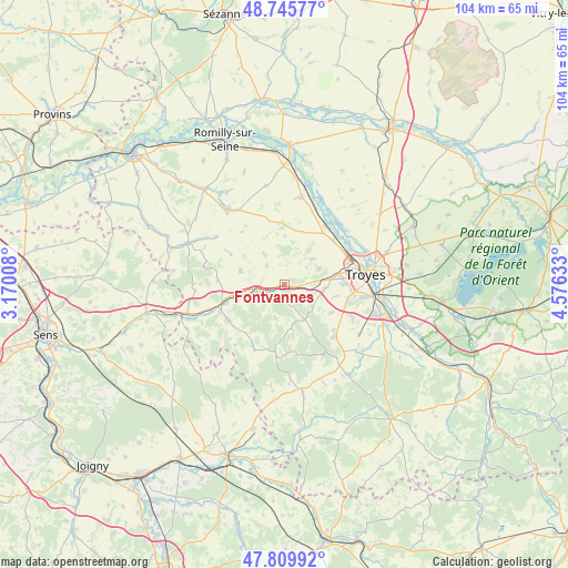
Fontvannes GPS coordinates[2]
48° 16' 47.964" North, 3° 52' 23.52" East
| Map corner | latitude | longitude |
|---|---|---|
| Upper-left | 48.74577°, | 3.17008° |
| Center: | 48.27999°, | 3.8732° |
| Lower-right: | 47.80992°, | 4.57633° |
| Map W x H: | 104.1×104.1 km | = 64.7×64.7mi |
| max Lat: | 51.07786° ⇑35.9% North |
| Fontvannes: | 48.27999° |
| min Lat: | ⇓64.1% South 41.3874° |
| min Long | Fontvannes | max Long |
| -5.08615° | 3.8732° | 9.52242° |
| W 66.8%⇐ | ⇒33.2% E |
Elevation
Elevation of Fontvannes is 150 m = 492 ft, and this is 43.7 m = 143 ft below average elevation for this country.
| Max E: |
2333 m = 7654 ft | 45% |
| Avg. | 193.7 m = 635 ft | |
| Fontvannes | 150 m = 492 ft | |
Min E: |
-1 m = -3 ft | 55% |
See also: France elevation on elevation.city.
Geographical zone
Fontvannes is located in North temperate zone (between Tropic of Cancer and the Arctic Circle). Distance of this North polar circle is 2032.9 km =1263.2 mi to North.| Distance of | km | miles | from Fontvannes |
|---|---|---|---|
| North Pole | 4638.8 | 2882.4 | to North |
| Arctic Circle | 2032.9 | 1263.2 | to North |
| Tropic Cancer | 2762.3 | 1716.4 | to South |
| Equator | 5368.2 | 3335.6 | to South |


Nearby cities:
15 places around Fontvannes: (largest is in red/bold)
• Aix-en-Othe
12 km =7.5 mi,  238°
238°
• Bouilly
13.2 km =8.2 mi,  134°
134°
• Estissac
5.2 km =3.2 mi,  256°
256°
• La Chapelle-Saint-Luc
13 km =8.1 mi,  71°
71°
• La Rivière-de-Corps
10.9 km =6.8 mi,  85°
85°
• Les Noës-près-Troyes
13 km =8.1 mi,  78°
78°
• Macey
3.4 km =2.1 mi,  64°
64°
• Mesnil-Saint-Loup
8.4 km =5.2 mi,  287°
287°
• Palis
12.8 km =8 mi,  271°
271°
• Saint-André-les-Vergers
13.3 km =8.3 mi, 87°
• Saint-Germain
12.1 km =7.5 mi,  102°
102°
• Saint-Lyé
13.3 km =8.3 mi,  44°
44°
• Saint-Mards-en-Othe
13.2 km =8.2 mi,  204°
204°
• Sainte-Savine
12.9 km =8 mi, 81°
• Torvilliers
7.5 km =4.7 mi, 94°
Sources, notices
• [Note1] Compared only with cities in France existing in our database
• [Src1] Map data: © OpenStreetMap contributors (CC-BY-SA)
• [Src2] Other city data from geonames.org with taken over terms of usage.
• [Src3] Geographical zone / Annual Mean Temperature by Robert A. Rohde @ Wikipedia
