Mesnil-Saint-Loup geodata
Mesnil-Saint-Loup (Grand Est) is a populated place; located in France in Europe/Paris (GMT+2) time zone. With population of 567 people, there are 13878 cities with bigger population in this country. Compared to other cities in France, 64.6% of cities are located further ↓South; 66.1% of cities are located further ←West and 59.6% of cities have lower elevation than Mesnil-Saint-Loup. Note1
Administrative division(s):
- Level 1: Grand Est
- Level 2: Département de l'Aube
- Level 3: Arrondissement de Nogent-sur-Seine
- Level 4: Mesnil-Saint-Loup


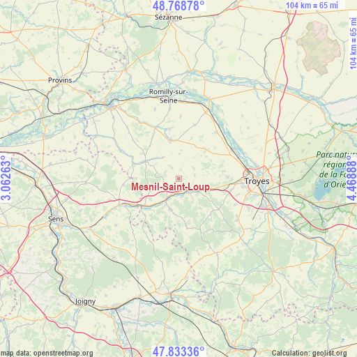
Mesnil-Saint-Loup GPS coordinates[2]
48° 18' 11.556" North, 3° 45' 56.7" East
| Map corner | latitude | longitude |
|---|---|---|
| Upper-left | 48.76878°, | 3.06263° |
| Center: | 48.30321°, | 3.76575° |
| Lower-right: | 47.83336°, | 4.46888° |
| Map W x H: | 104×104 km | = 64.6×64.6mi |
| max Lat: | 51.07786° ⇑35.4% North |
| Mesnil-Saint-Loup: | 48.30321° |
| min Lat: | ⇓64.6% South 41.3874° |
| min Long | Mesnil-Saint-Lo | max Long |
| -5.08615° | 3.76575° | 9.52242° |
| W 66.1%⇐ | ⇒33.9% E |
Elevation
Elevation of Mesnil-Saint-Loup is 168 m = 551 ft, and this is 25.7 m = 84 ft below average elevation for this country.
| Max E: |
2333 m = 7654 ft | 40.4% |
| Avg. | 193.7 m = 635 ft | |
| Mesnil-Saint-Loup | 168 m = 551 ft | |
Min E: |
-1 m = -3 ft | 59.6% |
See also: France elevation on elevation.city.
Geographical zone
Mesnil-Saint-Loup is located in North temperate zone (between Tropic of Cancer and the Arctic Circle). Distance of this North polar circle is 2030.4 km =1261.6 mi to North.| Distance of | km | miles | from Mesnil-Saint-Loup |
|---|---|---|---|
| North Pole | 4636.2 | 2880.8 | to North |
| Arctic Circle | 2030.4 | 1261.6 | to North |
| Tropic Cancer | 2764.9 | 1718 | to South |
| Equator | 5370.8 | 3337.3 | to South |


Nearby cities:
15 places around Mesnil-Saint-Loup: (largest is in red/bold)
• Aix-en-Othe
9.1 km =5.7 mi,  194°
194°
• Estissac
4.8 km =3 mi,  142°
142°
• Fontaine-les-Grès
16 km =9.9 mi,  38°
38°
• Fontvannes
8.4 km =5.2 mi,  107°
107°
• Macey
11.1 km =6.9 mi,  95°
95°
• Marcilly-le-Hayer
10.9 km =6.8 mi,  296°
296°
• Marigny-le-Châtel
11.3 km =7 mi,  348°
348°
• Origny-le-Sec
18.1 km =11.2 mi,  1°
1°
• Ossey-les-Trois-Maisons
14.9 km =9.3 mi, 353°
• Palis
5.3 km =3.3 mi,  245°
245°
• Payns
18 km =11.2 mi,  60°
60°
• Saint-Lyé
18.6 km =11.6 mi,  68°
68°
• Saint-Mards-en-Othe
14.7 km =9.1 mi,  170°
170°
• Savières
18 km =11.2 mi,  49°
49°
• Torvilliers
15.7 km =9.8 mi, 101°
Sources, notices
• [Note1] Compared only with cities in France existing in our database
• [Src1] Map data: © OpenStreetMap contributors (CC-BY-SA)
• [Src2] Other city data from geonames.org with taken over terms of usage.
• [Src3] Geographical zone / Annual Mean Temperature by Robert A. Rohde @ Wikipedia
