Aix-en-Othe geodata
Aix-en-Othe (Grand Est) is a populated place; located in France in Europe/Paris (GMT+2) time zone. With population of 2,167 people, there are 4429 cities with bigger population in this country. Compared to other cities in France, 63.2% of cities are located further ↓South; 65.9% of cities are located further ←West and 52.2% of cities have lower elevation than Aix-en-Othe. Note1
Administrative division(s):
- Level 1: Grand Est
- Level 2: Département de l'Aube
- Level 3: Arrondissement de Troyes
- Level 4: Aix-Villemaur-Pâlis


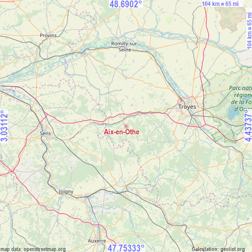
Aix-en-Othe GPS coordinates[2]
48° 13' 26.076" North, 3° 44' 3.3" East
| Map corner | latitude | longitude |
|---|---|---|
| Upper-left | 48.6902°, | 3.03112° |
| Center: | 48.22391°, | 3.73425° |
| Lower-right: | 47.75333°, | 4.43737° |
| Map W x H: | 104.2×104.2 km | = 64.7×64.7mi |
| max Lat: | 51.07786° ⇑36.8% North |
| Aix-en-Othe: | 48.22391° |
| min Lat: | ⇓63.2% South 41.3874° |
| min Long | Aix-en-Othe | max Long |
| -5.08615° | 3.73425° | 9.52242° |
| W 65.9%⇐ | ⇒34.1% E |
Elevation
Elevation of Aix-en-Othe is 140 m = 459 ft, and this is 53.7 m = 176 ft below average elevation for this country.
| Max E: |
2333 m = 7654 ft | 47.8% |
| Avg. | 193.7 m = 635 ft | |
| Aix-en-Othe | 140 m = 459 ft | |
Min E: |
-1 m = -3 ft | 52.2% |
See also: France elevation on elevation.city.
Geographical zone
Aix-en-Othe is located in North temperate zone (between Tropic of Cancer and the Arctic Circle). Distance of this North polar circle is 2039.2 km =1267.1 mi to North.| Distance of | km | miles | from Aix-en-Othe |
|---|---|---|---|
| North Pole | 4645.1 | 2886.3 | to North |
| Arctic Circle | 2039.2 | 1267.1 | to North |
| Tropic Cancer | 2756.1 | 1712.6 | to South |
| Equator | 5362 | 3331.8 | to South |


Nearby cities:
15 places around Aix-en-Othe: (largest is in red/bold)
• Arces-Dilo
18.5 km =11.5 mi,  212°
212°
• Auxon
19 km =11.8 mi,  134°
134°
• Bouilly
19.9 km =12.4 mi,  98°
98°
• Chailley
15.9 km =9.9 mi,  188°
188°
• Estissac
7.3 km =4.5 mi,  46°
46°
• Fontvannes
12 km =7.5 mi,  58°
58°
• Macey
15.5 km =9.6 mi, 60°
• Marcilly-le-Hayer
15.6 km =9.7 mi,  331°
331°
• Marigny-le-Châtel
19.9 km =12.4 mi,  0°
0°
• Mesnil-Saint-Loup
9.1 km =5.7 mi,  14°
14°
• Neuvy-Sautour
20.7 km =12.9 mi,  167°
167°
• Palis
7.1 km =4.4 mi,  339°
339°
• Saint-Mards-en-Othe
7.4 km =4.6 mi,  140°
140°
• Torvilliers
18.6 km =11.6 mi,  72°
72°
• Turny
21 km =13 mi,  177°
177°
Sources, notices
• [Note1] Compared only with cities in France existing in our database
• [Src1] Map data: © OpenStreetMap contributors (CC-BY-SA)
• [Src2] Other city data from geonames.org with taken over terms of usage.
• [Src3] Geographical zone / Annual Mean Temperature by Robert A. Rohde @ Wikipedia
