Estissac geodata
Estissac (Grand Est) is a populated place; located in France in Europe/Paris (GMT+2) time zone. With population of 1,746 people, there are 5426 cities with bigger population in this country. Compared to other cities in France, 64% of cities are located further ↓South; 66.4% of cities are located further ←West and 50.2% of cities have higher elevation than Estissac. Note1
Administrative division(s):
- Level 1: Grand Est
- Level 2: Département de l'Aube
- Level 3: Arrondissement de Troyes
- Level 4: Estissac


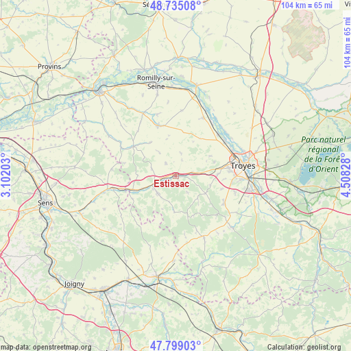
Estissac GPS coordinates[2]
48° 16' 9.12" North, 3° 48' 18.54" East
| Map corner | latitude | longitude |
|---|---|---|
| Upper-left | 48.73508°, | 3.10203° |
| Center: | 48.2692°, | 3.80515° |
| Lower-right: | 47.79903°, | 4.50828° |
| Map W x H: | 104.1×104.1 km | = 64.7×64.7mi |
| max Lat: | 51.07786° ⇑36% North |
| Estissac: | 48.2692° |
| min Lat: | ⇓64% South 41.3874° |
| min Long | Estissac | max Long |
| -5.08615° | 3.80515° | 9.52242° |
| W 66.4%⇐ | ⇒33.6% E |
Elevation
Elevation of Estissac is 131 m = 430 ft, and this is 62.7 m = 206 ft below average elevation for this country.
| Max E: |
2333 m = 7654 ft | 50.2% |
| Avg. | 193.7 m = 635 ft | |
| Estissac | 131 m = 430 ft | |
Min E: |
-1 m = -3 ft | 49.8% |
See also: France elevation on elevation.city.
Geographical zone
Estissac is located in North temperate zone (between Tropic of Cancer and the Arctic Circle). Distance of this North polar circle is 2034.1 km =1263.9 mi to North.| Distance of | km | miles | from Estissac |
|---|---|---|---|
| North Pole | 4640 | 2883.2 | to North |
| Arctic Circle | 2034.1 | 1263.9 | to North |
| Tropic Cancer | 2761.1 | 1715.7 | to South |
| Equator | 5367 | 3334.9 | to South |


Nearby cities:
15 places around Estissac: (largest is in red/bold)
• Aix-en-Othe
7.3 km =4.5 mi,  226°
226°
• Bouilly
16.5 km =10.3 mi,  119°
119°
• Fontaine-les-Grès
17.8 km =11.1 mi,  23°
23°
• Fontvannes
5.2 km =3.2 mi,  76°
76°
• La Rivière-de-Corps
16 km =9.9 mi, 82°
• Macey
8.6 km =5.3 mi,  71°
71°
• Marcilly-le-Hayer
15.4 km =9.6 mi,  304°
304°
• Marigny-le-Châtel
15.7 km =9.8 mi,  340°
340°
• Mesnil-Saint-Loup
4.8 km =3 mi,  322°
322°
• Palis
7.9 km =4.9 mi,  281°
281°
• Payns
17.9 km =11.1 mi,  45°
45°
• Saint-Germain
16.9 km =10.5 mi,  94°
94°
• Saint-Lyé
17.9 km =11.1 mi, 53°
• Saint-Mards-en-Othe
10.8 km =6.7 mi,  182°
182°
• Torvilliers
12.5 km =7.8 mi, 87°
Sources, notices
• [Note1] Compared only with cities in France existing in our database
• [Src1] Map data: © OpenStreetMap contributors (CC-BY-SA)
• [Src2] Other city data from geonames.org with taken over terms of usage.
• [Src3] Geographical zone / Annual Mean Temperature by Robert A. Rohde @ Wikipedia
