Barjouville geodata
Barjouville (Centre) is a populated place; located in France in Europe/Paris (GMT+2) time zone. With population of 1,473 people, there are 6285 cities with bigger population in this country. Compared to other cities in France, 66.5% of cities are located further ↓South; 63.3% of cities are located further →East and 54.2% of cities have lower elevation than Barjouville. Note1
Administrative division(s):
- Level 1: Centre
- Level 2: Département d'Eure-et-Loir
- Level 3: Arrondissement de Chartres
- Level 4: Barjouville


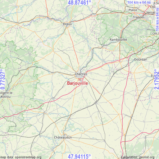
Barjouville GPS coordinates[2]
48° 24' 36.072" North, 1° 28' 35.004" East
| Map corner | latitude | longitude |
|---|---|---|
| Upper-left | 48.87461°, | 0.77327° |
| Center: | 48.41002°, | 1.47639° |
| Lower-right: | 47.94115°, | 2.17952° |
| Map W x H: | 103.8×103.8 km | = 64.5×64.5mi |
| max Lat: | 51.07786° ⇑33.5% North |
| Barjouville: | 48.41002° |
| min Lat: | ⇓66.5% South 41.3874° |
| min Long | Barjouville | max Long |
| -5.08615° | 1.47639° | 9.52242° |
| W 36.7%⇐ | ⇒63.3% E |
Elevation
Elevation of Barjouville is 147 m = 482 ft, and this is 46.7 m = 153 ft below average elevation for this country.
| Max E: |
2333 m = 7654 ft | 45.8% |
| Avg. | 193.7 m = 635 ft | |
| Barjouville | 147 m = 482 ft | |
Min E: |
-1 m = -3 ft | 54.2% |
See also: France elevation on elevation.city.
Geographical zone
Barjouville is located in North temperate zone (between Tropic of Cancer and the Arctic Circle). Distance of this North polar circle is 2018.5 km =1254.2 mi to North.| Distance of | km | miles | from Barjouville |
|---|---|---|---|
| North Pole | 4624.4 | 2873.5 | to North |
| Arctic Circle | 2018.5 | 1254.2 | to North |
| Tropic Cancer | 2776.8 | 1725.4 | to South |
| Equator | 5382.7 | 3344.7 | to South |


Nearby cities:
15 places around Barjouville: (largest is in red/bold)
• Amilly
7.2 km =4.5 mi,  301°
301°
• Berchères-les-Pierres
6.4 km =4 mi,  115°
115°
• Champhol
6.7 km =4.2 mi,  16°
16°
• Chartres
4.2 km =2.6 mi,  13°
13°
• Dammarie
7.6 km =4.7 mi,  169°
169°
• Fontenay-sur-Eure
5 km =3.1 mi,  251°
251°
• Gasville-Oisème
8.1 km =5 mi,  34°
34°
• Le Coudray
2.2 km =1.4 mi,  55°
55°
• Lucé
3.1 km =1.9 mi,  342°
342°
• Luisant
2.2 km =1.4 mi,  355°
355°
• Lèves
6.8 km =4.2 mi,  3°
3°
• Mainvilliers
4.7 km =2.9 mi, 341°
• Mignières
6.8 km =4.2 mi,  213°
213°
• Morancez
1.7 km =1.1 mi,  129°
129°
• Thivars
4 km =2.5 mi, 207°
Sources, notices
• [Note1] Compared only with cities in France existing in our database
• [Src1] Map data: © OpenStreetMap contributors (CC-BY-SA)
• [Src2] Other city data from geonames.org with taken over terms of usage.
• [Src3] Geographical zone / Annual Mean Temperature by Robert A. Rohde @ Wikipedia
