Fontenay-sous-Bois geodata
Fontenay-sous-Bois (Île-de-France) is a populated place; located in France in Europe/Paris (GMT+2) time zone. With population of 52,075 people, there are 117 cities with bigger population in this country. Compared to other cities in France, 76.7% of cities are located further ↓South; 50.3% of cities are located further ←West and 73.1% of cities have higher elevation than Fontenay-sous-Bois. Note1
Administrative division(s):
- Level 1: Île-de-France
- Level 2: Val-de-Marne
- Level 3: Arrondissement de Nogent-sur-Marne
- Level 4: Fontenay-sous-Bois


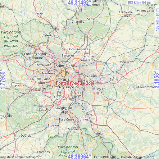
Fontenay-sous-Bois GPS coordinates[2]
48° 51' 15.912" North, 2° 28' 57.648" East
| Map corner | latitude | longitude |
|---|---|---|
| Upper-left | 49.31492°, | 1.77955° |
| Center: | 48.85442°, | 2.48268° |
| Lower-right: | 48.38964°, | 3.1858° |
| Map W x H: | 102.9×102.9 km | = 63.9×63.9mi |
| max Lat: | 51.07786° ⇑23.3% North |
| Fontenay-sous-Bois: | 48.85442° |
| min Lat: | ⇓76.7% South 41.3874° |
| min Long | Fontenay-sous-B | max Long |
| -5.08615° | 2.48268° | 9.52242° |
| W 50.3%⇐ | ⇒49.7% E |
Elevation
Elevation of Fontenay-sous-Bois is 71 m = 233 ft, and this is 122.7 m = 403 ft below average elevation for this country.
| Max E: |
2333 m = 7654 ft | 73.1% |
| Avg. | 193.7 m = 635 ft | |
| Fontenay-sous-Bois | 71 m = 233 ft | |
Min E: |
-1 m = -3 ft | 26.9% |
See also: Fontenay-sous-Bois elevation on elevation.city.
Geographical zone
Fontenay-sous-Bois is located in North temperate zone (between Tropic of Cancer and the Arctic Circle). Distance of this North polar circle is 1969.1 km =1223.5 mi to North.| Distance of | km | miles | from Fontenay-sous-Bois |
|---|---|---|---|
| North Pole | 4575 | 2842.8 | to North |
| Arctic Circle | 1969.1 | 1223.5 | to North |
| Tropic Cancer | 2826.2 | 1756.1 | to South |
| Equator | 5432.1 | 3375.3 | to South |


Nearby cities:
15 places around Fontenay-sous-Bois: (largest is in red/bold)
• Bagnolet
5 km =3.1 mi,  285°
285°
• Bry-sur-Marne
3.6 km =2.2 mi,  120°
120°
• Champigny-sur-Marne
4.3 km =2.7 mi,  169°
169°
• Gagny
4.9 km =3 mi,  49°
49°
• Joinville-le-Pont
3.3 km =2.1 mi,  190°
190°
• Le Perreux-sur-Marne
1.4 km =0.9 mi,  111°
111°
• Montreuil
3.1 km =1.9 mi, 290°
• Neuilly-Plaisance
2 km =1.2 mi,  59°
59°
• Neuilly-sur-Marne
4.9 km =3 mi,  90°
90°
• Nogent-sur-Marne
2 km =1.2 mi,  180°
180°
• Noisy-le-Sec
4.3 km =2.7 mi,  342°
342°
• Romainville
4.9 km =3 mi,  314°
314°
• Rosny-sous-Bois
2.1 km =1.3 mi,  34°
34°
• Villemomble
3.5 km =2.2 mi,  21°
21°
• Vincennes
3.4 km =2.1 mi,  258°
258°
Sources, notices
• [Note1] Compared only with cities in France existing in our database
• [Src1] Map data: © OpenStreetMap contributors (CC-BY-SA)
• [Src2] Other city data from geonames.org with taken over terms of usage.
• [Src3] Geographical zone / Annual Mean Temperature by Robert A. Rohde @ Wikipedia
