Bagnolet geodata
Bagnolet (Île-de-France) is a populated place; located in France in Europe/Paris (GMT+2) time zone. With population of 33,504 people, there are 233 cities with bigger population in this country. Compared to other cities in France, 77% of cities are located further ↓South; 50.8% of cities are located further →East and 68.3% of cities have higher elevation than Bagnolet. Note1
Administrative division(s):
- Level 1: Île-de-France
- Level 2: Seine-Saint-Denis
- Level 3: Arrondissement de Bobigny
- Level 4: Bagnolet


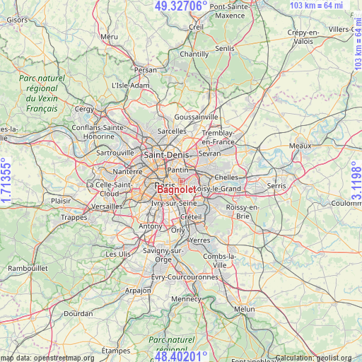
Bagnolet GPS coordinates[2]
48° 52' 0.012" North, 2° 25' 0.012" East
| Map corner | latitude | longitude |
|---|---|---|
| Upper-left | 49.32706°, | 1.71355° |
| Center: | 48.86667°, | 2.41667° |
| Lower-right: | 48.40201°, | 3.1198° |
| Map W x H: | 102.9×102.9 km | = 63.9×63.9mi |
| max Lat: | 51.07786° ⇑23% North |
| Bagnolet: | 48.86667° |
| min Lat: | ⇓77% South 41.3874° |
| min Long | Bagnolet | max Long |
| -5.08615° | 2.41667° | 9.52242° |
| W 49.2%⇐ | ⇒50.8% E |
Elevation
Elevation of Bagnolet is 82 m = 269 ft, and this is 111.7 m = 366 ft below average elevation for this country.
| Max E: |
2333 m = 7654 ft | 68.3% |
| Avg. | 193.7 m = 635 ft | |
| Bagnolet | 82 m = 269 ft | |
Min E: |
-1 m = -3 ft | 31.7% |
See also: France elevation on elevation.city.
Geographical zone
Bagnolet is located in North temperate zone (between Tropic of Cancer and the Arctic Circle). Distance of this North polar circle is 1967.7 km =1222.7 mi to North.| Distance of | km | miles | from Bagnolet |
|---|---|---|---|
| North Pole | 4573.6 | 2841.9 | to North |
| Arctic Circle | 1967.7 | 1222.7 | to North |
| Tropic Cancer | 2827.5 | 1756.9 | to South |
| Equator | 5433.5 | 3376.2 | to South |


Nearby cities:
15 places around Bagnolet: (largest is in red/bold)
• Bobigny
5.4 km =3.4 mi,  27°
27°
• Charenton-le-Pont
5 km =3.1 mi,  183°
183°
• Fontenay-sous-Bois
5 km =3.1 mi,  105°
105°
• Le Pré-Saint-Gervais
2.3 km =1.4 mi,  336°
336°
• Les Lilas
1.5 km =0.9 mi,  10°
10°
• Montreuil
2 km =1.2 mi,  98°
98°
• Nogent-sur-Marne
5.9 km =3.7 mi,  124°
124°
• Noisy-le-Sec
4.5 km =2.8 mi,  51°
51°
• Pantin
3.1 km =1.9 mi,  350°
350°
• Paris
5.2 km =3.2 mi,  253°
253°
• Romainville
2.5 km =1.6 mi, 32°
• Rosny-sous-Bois
6 km =3.7 mi,  86°
86°
• Saint-Mandé
3.1 km =1.9 mi, 181°
• Saint-Maurice
5 km =3.1 mi,  171°
171°
• Vincennes
2.5 km =1.6 mi,  142°
142°
Sources, notices
• [Note1] Compared only with cities in France existing in our database
• [Src1] Map data: © OpenStreetMap contributors (CC-BY-SA)
• [Src2] Other city data from geonames.org with taken over terms of usage.
• [Src3] Geographical zone / Annual Mean Temperature by Robert A. Rohde @ Wikipedia
