Cuy geodata
Cuy (Bourgogne-Franche-Comté) is a populated place; located in France in Europe/Paris (GMT+2) time zone. With population of 663 people, there are 12328 cities with bigger population in this country. Compared to other cities in France, 63.8% of cities are located further ↓South; 61.6% of cities are located further ←West and 75.8% of cities have higher elevation than Cuy. Note1
Administrative division(s):
- Level 1: Bourgogne-Franche-Comté
- Level 2: Département de l'Yonne
- Level 3: Arrondissement de Sens
- Level 4: Cuy


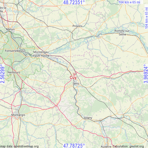
Cuy GPS coordinates[2]
48° 15' 27.072" North, 3° 15' 57.996" East
| Map corner | latitude | longitude |
|---|---|---|
| Upper-left | 48.72351°, | 2.56299° |
| Center: | 48.25752°, | 3.26611° |
| Lower-right: | 47.78725°, | 3.96924° |
| Map W x H: | 104.1×104.1 km | = 64.7×64.7mi |
| max Lat: | 51.07786° ⇑36.2% North |
| Cuy: | 48.25752° |
| min Lat: | ⇓63.8% South 41.3874° |
| min Long | Cuy | max Long |
| -5.08615° | 3.26611° | 9.52242° |
| W 61.6%⇐ | ⇒38.4% E |
Elevation
Elevation of Cuy is 65 m = 213 ft, and this is 128.7 m = 422 ft below average elevation for this country.
| Max E: |
2333 m = 7654 ft | 75.8% |
| Avg. | 193.7 m = 635 ft | |
| Cuy | 65 m = 213 ft | |
Min E: |
-1 m = -3 ft | 24.2% |
See also: France elevation on elevation.city.
Geographical zone
Cuy is located in North temperate zone (between Tropic of Cancer and the Arctic Circle). Distance of this North polar circle is 2035.4 km =1264.7 mi to North.| Distance of | km | miles | from Cuy |
|---|---|---|---|
| North Pole | 4641.3 | 2884 | to North |
| Arctic Circle | 2035.4 | 1264.7 | to North |
| Tropic Cancer | 2759.8 | 1714.9 | to South |
| Equator | 5365.7 | 3334.1 | to South |


Nearby cities:
15 places around Cuy: (largest is in red/bold)
• Courtois-sur-Yonne
3.5 km =2.2 mi,  193°
193°
• Fontaine-la-Gaillarde
9.3 km =5.8 mi,  116°
116°
• Gisy-les-Nobles
3.2 km =2 mi,  327°
327°
• Maillot
9.6 km =6 mi,  161°
161°
• Michery
6.3 km =3.9 mi,  337°
337°
• Paron
8.8 km =5.5 mi, 187°
• Pont-sur-Yonne
5.5 km =3.4 mi,  300°
300°
• Saint-Clément
5 km =3.1 mi,  153°
153°
• Saint-Denis-lès-Sens
3.3 km =2.1 mi,  179°
179°
• Saint-Martin-du-Tertre
4.6 km =2.9 mi, 184°
• Saligny
8 km =5 mi,  127°
127°
• Sens
6.8 km =4.2 mi,  169°
169°
• Sergines
9.4 km =5.8 mi,  358°
358°
• Soucy
4.4 km =2.7 mi,  101°
101°
• Villemanoche
7.9 km =4.9 mi,  306°
306°
Sources, notices
• [Note1] Compared only with cities in France existing in our database
• [Src1] Map data: © OpenStreetMap contributors (CC-BY-SA)
• [Src2] Other city data from geonames.org with taken over terms of usage.
• [Src3] Geographical zone / Annual Mean Temperature by Robert A. Rohde @ Wikipedia
