Ferney-Voltaire geodata
Ferney-Voltaire (Auvergne-Rhône-Alpes) is a populated place; located in France in Europe/Paris (GMT+2) time zone. With population of 7,742 people, there are 1250 cities with bigger population in this country. Compared to other cities in France, 62.8% of cities are located further ↑North; 88.3% of cities are located further ←West and 90% of cities have lower elevation than Ferney-Voltaire. Note1
Administrative division(s):
- Level 1: Auvergne-Rhône-Alpes
- Level 2: Département de l'Ain
- Level 3: Arrondissement de Gex
- Level 4: Ferney-Voltaire


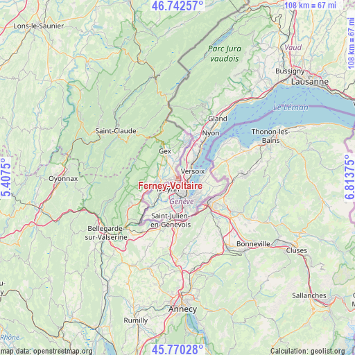
Ferney-Voltaire GPS coordinates[2]
46° 15' 30.888" North, 6° 6' 38.268" East
| Map corner | latitude | longitude |
|---|---|---|
| Upper-left | 46.74257°, | 5.4075° |
| Center: | 46.25858°, | 6.11063° |
| Lower-right: | 45.77028°, | 6.81375° |
| Map W x H: | 108.1×108.1 km | = 67.2×67.2mi |
| max Lat: | 51.07786° ⇑62.8% North |
| Ferney-Voltaire: | 46.25858° |
| min Lat: | ⇓37.2% South 41.3874° |
| min Long | Ferney-Voltaire | max Long |
| -5.08615° | 6.11063° | 9.52242° |
| W 88.3%⇐ | ⇒11.7% E |
Elevation
Elevation of Ferney-Voltaire is 425 m = 1394 ft, and this is 231.3 m = 759 ft above average elevation for this country.
| Max E: |
2333 m = 7654 ft | 10% |
| Ferney-Voltaire | 425 m 1394 ft | |
| Avg. | 193.7 m = 635 ft | |
Min E: |
-1 m = -3 ft | 90% |
See also: France elevation on elevation.city.
Geographical zone
Ferney-Voltaire is located in North temperate zone (between Tropic of Cancer and the Arctic Circle). Distance of this North polar circle is 2257.7 km =1402.9 mi to North.| Distance of | km | miles | from Ferney-Voltaire |
|---|---|---|---|
| North Pole | 4863.6 | 3022.1 | to North |
| Arctic Circle | 2257.7 | 1402.9 | to North |
| Tropic Cancer | 2537.6 | 1576.8 | to South |
| Equator | 5143.5 | 3196 | to South |


Nearby cities:
15 places around Ferney-Voltaire: (largest is in red/bold)
• Annemasse
12.1 km =7.5 mi,  126°
126°
• Cessy
7.4 km =4.6 mi,  338°
338°
• Chevry
6.1 km =3.8 mi,  294°
294°
• Divonne-les-Bains
11.1 km =6.9 mi,  9°
9°
• Gaillard
11 km =6.8 mi,  137°
137°
• Gex
9.2 km =5.7 mi,  333°
333°
• Grilly
8.1 km =5 mi,  1°
1°
• Ornex
1.8 km =1.1 mi, 332°
• Saint-Genis-Pouilly
7.1 km =4.4 mi,  256°
256°
• Sauverny
6.3 km =3.9 mi, 5°
• Sergy
8.4 km =5.2 mi, 264°
• Ségny
5.1 km =3.2 mi,  324°
324°
• Thoiry
10.2 km =6.3 mi, 256°
• Veigy
11.8 km =7.3 mi,  84°
84°
• Échenevex
7.8 km =4.8 mi, 315°
Sources, notices
• [Note1] Compared only with cities in France existing in our database
• [Src1] Map data: © OpenStreetMap contributors (CC-BY-SA)
• [Src2] Other city data from geonames.org with taken over terms of usage.
• [Src3] Geographical zone / Annual Mean Temperature by Robert A. Rohde @ Wikipedia
