Échenevex geodata
Échenevex (Auvergne-Rhône-Alpes) is a populated place; located in France in Europe/Paris (GMT+2) time zone. With population of 1,321 people, there are 6934 cities with bigger population in this country. Compared to other cities in France, 62.2% of cities are located further ↑North; 87.5% of cities are located further ←West and 94.9% of cities have lower elevation than Échenevex. Note1
Administrative division(s):
- Level 1: Auvergne-Rhône-Alpes
- Level 2: Département de l'Ain
- Level 3: Arrondissement de Gex
- Level 4: Échenevex


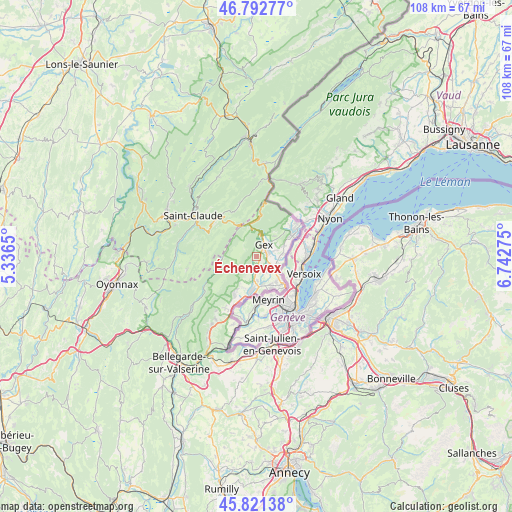
Échenevex GPS coordinates[2]
46° 18' 33.228" North, 6° 2' 22.668" East
| Map corner | latitude | longitude |
|---|---|---|
| Upper-left | 46.79277°, | 5.3365° |
| Center: | 46.30923°, | 6.03963° |
| Lower-right: | 45.82138°, | 6.74275° |
| Map W x H: | 108×108 km | = 67.1×67.1mi |
| max Lat: | 51.07786° ⇑62.2% North |
| Échenevex: | 46.30923° |
| min Lat: | ⇓37.8% South 41.3874° |
| min Long | Échenevex | max Long |
| -5.08615° | 6.03963° | 9.52242° |
| W 87.5%⇐ | ⇒12.5% E |
Elevation
Elevation of Échenevex is 580 m = 1903 ft, and this is 386.3 m = 1267 ft above average elevation for this country.
| Max E: |
2333 m = 7654 ft | 5.1% |
| Échenevex | 580 m 1903 ft | |
| Avg. | 193.7 m = 635 ft | |
Min E: |
-1 m = -3 ft | 94.9% |
See also: France elevation on elevation.city.
Geographical zone
Échenevex is located in North temperate zone (between Tropic of Cancer and the Arctic Circle). Distance of this North polar circle is 2252.1 km =1399.4 mi to North.| Distance of | km | miles | from Échenevex |
|---|---|---|---|
| North Pole | 4858 | 3018.6 | to North |
| Arctic Circle | 2252.1 | 1399.4 | to North |
| Tropic Cancer | 2543.2 | 1580.3 | to South |
| Equator | 5149.1 | 3199.5 | to South |


Nearby cities:
15 places around Échenevex: (largest is in red/bold)
• Cessy
3 km =1.9 mi,  65°
65°
• Challex
14.7 km =9.1 mi,  199°
199°
• Chevry
3.1 km =1.9 mi,  181°
181°
• Divonne-les-Bains
9 km =5.6 mi,  53°
53°
• Ferney-Voltaire
7.8 km =4.8 mi,  135°
135°
• Gex
3 km =1.9 mi,  27°
27°
• Grilly
6.2 km =3.9 mi, 66°
• Ornex
6.2 km =3.9 mi,  131°
131°
• Saint-Genis-Pouilly
7.4 km =4.6 mi,  190°
190°
• Saint-Jean-de-Gonville
12.7 km =7.9 mi,  212°
212°
• Sauverny
6.1 km =3.8 mi,  83°
83°
• Septmoncel
11.9 km =7.4 mi,  305°
305°
• Sergy
7.1 km =4.4 mi, 204°
• Ségny
2.9 km =1.8 mi,  120°
120°
• Thoiry
9.1 km =5.7 mi, 209°
Sources, notices
• [Note1] Compared only with cities in France existing in our database
• [Src1] Map data: © OpenStreetMap contributors (CC-BY-SA)
• [Src2] Other city data from geonames.org with taken over terms of usage.
• [Src3] Geographical zone / Annual Mean Temperature by Robert A. Rohde @ Wikipedia
