Favières geodata
Favières (Île-de-France) is a populated place; located in France in Europe/Paris (GMT+2) time zone. With population of 1,025 people, there are 8651 cities with bigger population in this country. Compared to other cities in France, 74.7% of cities are located further ↓South; 54.6% of cities are located further ←West and 59.4% of cities have higher elevation than Favières. Note1
Administrative division(s):
- Level 1: Île-de-France
- Level 2: Seine-et-Marne
- Level 3: Arrondissement de Provins
- Level 4: Favières


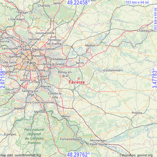
Favières GPS coordinates[2]
48° 45' 47.664" North, 2° 46' 28.92" East
| Map corner | latitude | longitude |
|---|---|---|
| Upper-left | 49.22458°, | 2.07158° |
| Center: | 48.76324°, | 2.7747° |
| Lower-right: | 48.29762°, | 3.47783° |
| Map W x H: | 103.1×103.1 km | = 64.1×64.1mi |
| max Lat: | 51.07786° ⇑25.3% North |
| Favières: | 48.76324° |
| min Lat: | ⇓74.7% South 41.3874° |
| min Long | Favières | max Long |
| -5.08615° | 2.7747° | 9.52242° |
| W 54.6%⇐ | ⇒45.4% E |
Elevation
Elevation of Favières is 104 m = 341 ft, and this is 89.7 m = 294 ft below average elevation for this country.
| Max E: |
2333 m = 7654 ft | 59.4% |
| Avg. | 193.7 m = 635 ft | |
| Favières | 104 m = 341 ft | |
Min E: |
-1 m = -3 ft | 40.6% |
See also: France elevation on elevation.city.
Geographical zone
Favières is located in North temperate zone (between Tropic of Cancer and the Arctic Circle). Distance of this North polar circle is 1979.2 km =1229.8 mi to North.| Distance of | km | miles | from Favières |
|---|---|---|---|
| North Pole | 4585.1 | 2849 | to North |
| Arctic Circle | 1979.2 | 1229.8 | to North |
| Tropic Cancer | 2816 | 1749.8 | to South |
| Equator | 5422 | 3369.1 | to South |


Nearby cities:
15 places around Favières: (largest is in red/bold)
• Châtres
6.4 km =4 mi,  156°
156°
• Ferrières-en-Brie
8.4 km =5.2 mi,  323°
323°
• Gretz-Armainvilliers
4 km =2.5 mi,  232°
232°
• Jossigny
8.4 km =5.2 mi,  349°
349°
• La Houssaye-en-Brie
6.7 km =4.2 mi,  98°
98°
• Liverdy-en-Brie
7 km =4.3 mi,  179°
179°
• Marles-en-Brie
8.7 km =5.4 mi,  117°
117°
• Neufmoutiers-en-Brie
4.2 km =2.6 mi,  81°
81°
• Ozoir-la-Ferrière
7.8 km =4.8 mi,  273°
273°
• Pontcarré
6.4 km =4 mi,  306°
306°
• Presles-en-Brie
5.9 km =3.7 mi,  204°
204°
• Serris
9.2 km =5.7 mi,  5°
5°
• Tournan-en-Brie
2.4 km =1.5 mi, 184°
• Villeneuve-Saint-Denis
6 km =3.7 mi, 13°
• Villeneuve-le-Comte
6.9 km =4.3 mi,  35°
35°
Sources, notices
• [Note1] Compared only with cities in France existing in our database
• [Src1] Map data: © OpenStreetMap contributors (CC-BY-SA)
• [Src2] Other city data from geonames.org with taken over terms of usage.
• [Src3] Geographical zone / Annual Mean Temperature by Robert A. Rohde @ Wikipedia
