Bazoches-lès-Bray geodata
Bazoches-lès-Bray (Île-de-France) is a populated place; located in France in Europe/Paris (GMT+2) time zone. With population of 782 people, there are 10798 cities with bigger population in this country. Compared to other cities in France, 66.3% of cities are located further ↓South; 60.4% of cities are located further ←West and 74.6% of cities have higher elevation than Bazoches-lès-Bray. Note1
Administrative division(s):
- Level 1: Île-de-France
- Level 2: Seine-et-Marne
- Level 3: Arrondissement de Provins
- Level 4: Bazoches-lès-Bray


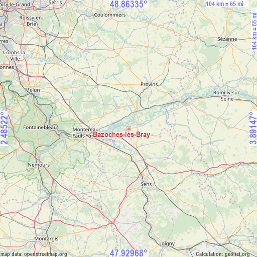
Bazoches-lès-Bray GPS coordinates[2]
48° 23' 55.176" North, 3° 11' 18.024" East
| Map corner | latitude | longitude |
|---|---|---|
| Upper-left | 48.86335°, | 2.48522° |
| Center: | 48.39866°, | 3.18834° |
| Lower-right: | 47.92968°, | 3.89147° |
| Map W x H: | 103.8×103.8 km | = 64.5×64.5mi |
| max Lat: | 51.07786° ⇑33.7% North |
| Bazoches-lès-Bray: | 48.39866° |
| min Lat: | ⇓66.3% South 41.3874° |
| min Long | Bazoches-lès-B | max Long |
| -5.08615° | 3.18834° | 9.52242° |
| W 60.4%⇐ | ⇒39.6% E |
Elevation
Elevation of Bazoches-lès-Bray is 68 m = 223 ft, and this is 125.7 m = 412 ft below average elevation for this country.
| Max E: |
2333 m = 7654 ft | 74.6% |
| Avg. | 193.7 m = 635 ft | |
| Bazoches-lès-Bray | 68 m = 223 ft | |
Min E: |
-1 m = -3 ft | 25.4% |
See also: France elevation on elevation.city.
Geographical zone
Bazoches-lès-Bray is located in North temperate zone (between Tropic of Cancer and the Arctic Circle). Distance of this North polar circle is 2019.7 km =1255 mi to North.| Distance of | km | miles | from Bazoches-lès-Bray |
|---|---|---|---|
| North Pole | 4625.6 | 2874.2 | to North |
| Arctic Circle | 2019.7 | 1255 | to North |
| Tropic Cancer | 2775.5 | 1724.6 | to South |
| Equator | 5381.4 | 3343.8 | to South |


Nearby cities:
15 places around Bazoches-lès-Bray: (largest is in red/bold)
• Bray-sur-Seine
4.1 km =2.5 mi,  65°
65°
• Chalmaison
10.4 km =6.5 mi,  26°
26°
• Champigny
10 km =6.2 mi,  204°
204°
• Chaumont
10.5 km =6.5 mi,  215°
215°
• Châtenay-sur-Seine
7.2 km =4.5 mi,  287°
287°
• Courlon-sur-Yonne
6.8 km =4.2 mi,  193°
193°
• Donnemarie-Dontilly
9.7 km =6 mi,  334°
334°
• Everly
8.8 km =5.5 mi, 31°
• Les Ormes-sur-Voulzie
7.8 km =4.8 mi,  22°
22°
• Michery
10.4 km =6.5 mi,  161°
161°
• Misy-sur-Yonne
8.4 km =5.2 mi,  239°
239°
• Montigny-Lencoup
10.8 km =6.7 mi,  302°
302°
• Mousseaux-lès-Bray
3.4 km =2.1 mi,  58°
58°
• Sergines
8.3 km =5.2 mi,  139°
139°
• Vinneuf
6.7 km =4.2 mi,  212°
212°
Sources, notices
• [Note1] Compared only with cities in France existing in our database
• [Src1] Map data: © OpenStreetMap contributors (CC-BY-SA)
• [Src2] Other city data from geonames.org with taken over terms of usage.
• [Src3] Geographical zone / Annual Mean Temperature by Robert A. Rohde @ Wikipedia
