Étival-Clairefontaine geodata
Étival-Clairefontaine (Grand Est) is a populated place; located in France in Europe/Paris (GMT+2) time zone. With population of 2,445 people, there are 3962 cities with bigger population in this country. Compared to other cities in France, 65.8% of cities are located further ↓South; 94% of cities are located further ←West and 82.4% of cities have lower elevation than Étival-Clairefontaine. Note1
Administrative division(s):
- Level 1: Grand Est
- Level 2: Vosges
- Level 3: Arrondissement de Saint-Dié-des-Vosges
- Level 4: Étival-Clairefontaine
Current local time in Étival-Clairefontaine:
02:50 AM, SaturdayDifference from your time zone: hours


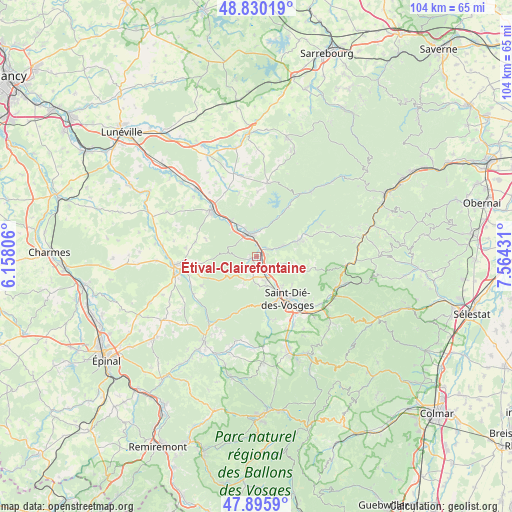
Étival-Clairefontaine GPS coordinates[2]
48° 21' 54.684" North, 6° 51' 40.248" East
| Map corner | latitude | longitude |
|---|---|---|
| Upper-left | 48.83019°, | 6.15806° |
| Center: | 48.36519°, | 6.86118° |
| Lower-right: | 47.8959°, | 7.56431° |
| Map W x H: | 103.9×103.9 km | = 64.6×64.6mi |
| max Lat: | 51.07786° ⇑34.2% North |
| Étival-Clairefontaine: | 48.36519° |
| min Lat: | ⇓65.8% South 41.3874° |
| min Long | Étival-Clairef | max Long |
| -5.08615° | 6.86118° | 9.52242° |
| W 94%⇐ | ⇒6% E |
Elevation
Elevation of Étival-Clairefontaine is 314 m = 1030 ft, and this is 120.3 m = 395 ft above average elevation for this country.
| Max E: |
2333 m = 7654 ft | 17.6% |
| Étival-Clairefontaine | 314 m 1030 ft | |
| Avg. | 193.7 m = 635 ft | |
Min E: |
-1 m = -3 ft | 82.4% |
See also: France elevation on elevation.city.
Geographical zone
Étival-Clairefontaine is located in North temperate zone (between Tropic of Cancer and the Arctic Circle). Distance of this North polar circle is 2023.5 km =1257.3 mi to North.| Distance of | km | miles | from Étival-Clairefontaine |
|---|---|---|---|
| North Pole | 4629.4 | 2876.6 | to North |
| Arctic Circle | 2023.5 | 1257.3 | to North |
| Tropic Cancer | 2771.8 | 1722.3 | to South |
| Equator | 5377.7 | 3341.5 | to South |


Nearby cities:
15 places around Étival-Clairefontaine: (largest is in red/bold)
• Baccarat
13 km =8.1 mi,  316°
316°
• Brû
13.3 km =8.3 mi,  261°
261°
• Celles-sur-Plaine
11.8 km =7.3 mi,  33°
33°
• Jeanménil
13.2 km =8.2 mi, 255°
• La Bourgonce
6.5 km =4 mi,  202°
202°
• La Petite-Raon
10.9 km =6.8 mi,  65°
65°
• La Voivre
4.9 km =3 mi,  140°
140°
• Moussey
13.6 km =8.5 mi,  59°
59°
• Moyenmoutier
3.2 km =2 mi, 65°
• Nayemont-les-Fosses
13.2 km =8.2 mi,  125°
125°
• Nompatelize
4.5 km =2.8 mi,  188°
188°
• Saint-Dié-des-Vosges
11.2 km =7 mi, 144°
• Saint-Michel-sur-Meurthe
5.2 km =3.2 mi,  155°
155°
• Senones
9.2 km =5.7 mi, 69°
• Taintrux
13.2 km =8.2 mi,  167°
167°
Sources, notices
• [Note1] Compared only with cities in France existing in our database
• [Src1] Map data: © OpenStreetMap contributors (CC-BY-SA)
• [Src2] Other city data from geonames.org with taken over terms of usage.
• [Src3] Geographical zone / Annual Mean Temperature by Robert A. Rohde @ Wikipedia
