Senones geodata
Senones (Grand Est) is a populated place; located in France in Europe/Paris (GMT+2) time zone. With population of 2,947 people, there are 3306 cities with bigger population in this country. Compared to other cities in France, 66.2% of cities are located further ↓South; 94.7% of cities are located further ←West and 84.3% of cities have lower elevation than Senones. Note1
Administrative division(s):
- Level 1: Grand Est
- Level 2: Vosges
- Level 3: Arrondissement de Saint-Dié-des-Vosges
- Level 4: Senones


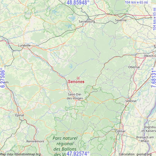
Senones GPS coordinates[2]
48° 23' 41.1" North, 6° 58' 41.448" East
| Map corner | latitude | longitude |
|---|---|---|
| Upper-left | 48.85948°, | 6.27506° |
| Center: | 48.39475°, | 6.97818° |
| Lower-right: | 47.92574°, | 7.68131° |
| Map W x H: | 103.8×103.8 km | = 64.5×64.5mi |
| max Lat: | 51.07786° ⇑33.8% North |
| Senones: | 48.39475° |
| min Lat: | ⇓66.2% South 41.3874° |
| min Long | Senones | max Long |
| -5.08615° | 6.97818° | 9.52242° |
| W 94.7%⇐ | ⇒5.3% E |
Elevation
Elevation of Senones is 338 m = 1109 ft, and this is 144.3 m = 473 ft above average elevation for this country.
| Max E: |
2333 m = 7654 ft | 15.7% |
| Senones | 338 m 1109 ft | |
| Avg. | 193.7 m = 635 ft | |
Min E: |
-1 m = -3 ft | 84.3% |
See also: France elevation on elevation.city.
Geographical zone
Senones is located in North temperate zone (between Tropic of Cancer and the Arctic Circle). Distance of this North polar circle is 2020.2 km =1255.3 mi to North.| Distance of | km | miles | from Senones |
|---|---|---|---|
| North Pole | 4626.1 | 2874.5 | to North |
| Arctic Circle | 2020.2 | 1255.3 | to North |
| Tropic Cancer | 2775.1 | 1724.4 | to South |
| Equator | 5381 | 3343.6 | to South |


Nearby cities:
15 places around Senones: (largest is in red/bold)
• Badonviller
13.4 km =8.3 mi,  331°
331°
• Celles-sur-Plaine
6.9 km =4.3 mi,  342°
342°
• Colroy-la-Grande
13 km =8.1 mi,  131°
131°
• La Petite-Raon
1.7 km =1.1 mi,  45°
45°
• La Voivre
9 km =5.6 mi,  218°
218°
• Moussey
4.7 km =2.9 mi,  39°
39°
• Moyenmoutier
6.1 km =3.8 mi,  251°
251°
• Nayemont-les-Fosses
11.1 km =6.9 mi,  168°
168°
• Nompatelize
12.1 km =7.5 mi,  230°
230°
• Plaine
12.6 km =7.8 mi,  78°
78°
• Provenchères-sur-Fave
12.2 km =7.6 mi,  142°
142°
• Saales
10.7 km =6.6 mi,  117°
117°
• Saint-Dié-des-Vosges
12.6 km =7.8 mi,  189°
189°
• Saint-Michel-sur-Meurthe
10.4 km =6.5 mi, 218°
• Étival-Clairefontaine
9.2 km =5.7 mi, 249°
Sources, notices
• [Note1] Compared only with cities in France existing in our database
• [Src1] Map data: © OpenStreetMap contributors (CC-BY-SA)
• [Src2] Other city data from geonames.org with taken over terms of usage.
• [Src3] Geographical zone / Annual Mean Temperature by Robert A. Rohde @ Wikipedia
