Brû geodata
Brû (Grand Est) is a populated place; located in France in Europe/Paris (GMT+2) time zone. With population of 571 people, there are 13815 cities with bigger population in this country. Compared to other cities in France, 65.4% of cities are located further ↓South; 92.9% of cities are located further ←West and 81.9% of cities have lower elevation than Brû. Note1
Administrative division(s):
- Level 1: Grand Est
- Level 2: Vosges
- Level 3: Arrondissement d’Épinal
- Level 4: Brû


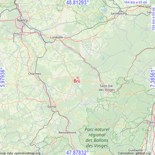
Brû GPS coordinates[2]
48° 20' 51.972" North, 6° 40' 56.928" East
| Map corner | latitude | longitude |
|---|---|---|
| Upper-left | 48.81293°, | 5.97936° |
| Center: | 48.34777°, | 6.68248° |
| Lower-right: | 47.87832°, | 7.38561° |
| Map W x H: | 103.9×103.9 km | = 64.6×64.6mi |
| max Lat: | 51.07786° ⇑34.6% North |
| Brû: | 48.34777° |
| min Lat: | ⇓65.4% South 41.3874° |
| min Long | Brû | max Long |
| -5.08615° | 6.68248° | 9.52242° |
| W 92.9%⇐ | ⇒7.1% E |
Elevation
Elevation of Brû is 310 m = 1017 ft, and this is 116.3 m = 382 ft above average elevation for this country.
| Max E: |
2333 m = 7654 ft | 18.1% |
| Brû | 310 m 1017 ft | |
| Avg. | 193.7 m = 635 ft | |
Min E: |
-1 m = -3 ft | 81.9% |
See also: France elevation on elevation.city.
Geographical zone
Brû is located in North temperate zone (between Tropic of Cancer and the Arctic Circle). Distance of this North polar circle is 2025.4 km =1258.5 mi to North.| Distance of | km | miles | from Brû |
|---|---|---|---|
| North Pole | 4631.3 | 2877.8 | to North |
| Arctic Circle | 2025.4 | 1258.5 | to North |
| Tropic Cancer | 2769.8 | 1721.1 | to South |
| Equator | 5375.8 | 3340.4 | to South |


Nearby cities:
15 places around Brû: (largest is in red/bold)
• Aydoilles
17.3 km =10.7 mi,  207°
207°
• Azerailles
15.7 km =9.8 mi,  3°
3°
• Baccarat
12.1 km =7.5 mi,  20°
20°
• Brouvelieures
12.8 km =8 mi,  163°
163°
• Bruyères
15.9 km =9.9 mi,  170°
170°
• Champ-le-Duc
17.1 km =10.6 mi, 170°
• Grandvillers
12.3 km =7.6 mi,  189°
189°
• Jeanménil
1.4 km =0.9 mi, 164°
• La Bourgonce
11.4 km =7.1 mi,  110°
110°
• La Voivre
16.4 km =10.2 mi,  96°
96°
• Moyenmoutier
16.4 km =10.2 mi,  78°
78°
• Nompatelize
12.8 km =8 mi, 101°
• Rambervillers
3.5 km =2.2 mi,  260°
260°
• Saint-Michel-sur-Meurthe
15.6 km =9.7 mi, 100°
• Étival-Clairefontaine
13.3 km =8.3 mi, 81°
Sources, notices
• [Note1] Compared only with cities in France existing in our database
• [Src1] Map data: © OpenStreetMap contributors (CC-BY-SA)
• [Src2] Other city data from geonames.org with taken over terms of usage.
• [Src3] Geographical zone / Annual Mean Temperature by Robert A. Rohde @ Wikipedia
