Moussey geodata
Moussey (Grand Est) is a populated place; located in France in Europe/Paris (GMT+2) time zone. With population of 736 people, there are 11334 cities with bigger population in this country. Compared to other cities in France, 66.8% of cities are located further ↓South; 94.9% of cities are located further ←West and 87% of cities have lower elevation than Moussey. Note1
Administrative division(s):
- Level 1: Grand Est
- Level 2: Vosges
- Level 3: Arrondissement de Saint-Dié-des-Vosges
- Level 4: Moussey


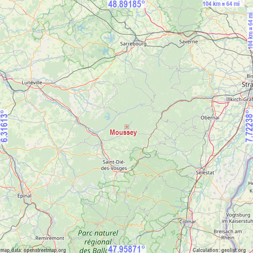
Moussey GPS coordinates[2]
48° 25' 38.712" North, 7° 1' 9.3" East
| Map corner | latitude | longitude |
|---|---|---|
| Upper-left | 48.89185°, | 6.31613° |
| Center: | 48.42742°, | 7.01925° |
| Lower-right: | 47.95871°, | 7.72238° |
| Map W x H: | 103.8×103.8 km | = 64.5×64.5mi |
| max Lat: | 51.07786° ⇑33.2% North |
| Moussey: | 48.42742° |
| min Lat: | ⇓66.8% South 41.3874° |
| min Long | Moussey | max Long |
| -5.08615° | 7.01925° | 9.52242° |
| W 94.9%⇐ | ⇒5.1% E |
Elevation
Elevation of Moussey is 374 m = 1227 ft, and this is 180.3 m = 592 ft above average elevation for this country.
| Max E: |
2333 m = 7654 ft | 13% |
| Moussey | 374 m 1227 ft | |
| Avg. | 193.7 m = 635 ft | |
Min E: |
-1 m = -3 ft | 87% |
See also: France elevation on elevation.city.
Geographical zone
Moussey is located in North temperate zone (between Tropic of Cancer and the Arctic Circle). Distance of this North polar circle is 2016.5 km =1253 mi to North.| Distance of | km | miles | from Moussey |
|---|---|---|---|
| North Pole | 4622.4 | 2872.2 | to North |
| Arctic Circle | 2016.5 | 1253 | to North |
| Tropic Cancer | 2778.7 | 1726.6 | to South |
| Equator | 5384.6 | 3345.8 | to South |


Nearby cities:
15 places around Moussey: (largest is in red/bold)
• Badonviller
12.4 km =7.7 mi,  311°
311°
• Celles-sur-Plaine
5.9 km =3.7 mi,  299°
299°
• Colroy-la-Grande
14 km =8.7 mi,  151°
151°
• La Broque
15.4 km =9.6 mi,  70°
70°
• La Petite-Raon
3 km =1.9 mi,  216°
216°
• La Voivre
13.7 km =8.5 mi, 218°
• Moyenmoutier
10.4 km =6.5 mi,  237°
237°
• Nayemont-les-Fosses
14.5 km =9 mi,  183°
183°
• Plaine
9.4 km =5.8 mi,  96°
96°
• Provenchères-sur-Fave
14 km =8.7 mi,  161°
161°
• Rothau
14.3 km =8.9 mi,  76°
76°
• Saales
10.8 km =6.7 mi,  143°
143°
• Saint-Michel-sur-Meurthe
15.1 km =9.4 mi, 219°
• Senones
4.7 km =2.9 mi, 219°
• Étival-Clairefontaine
13.6 km =8.5 mi, 239°
Sources, notices
• [Note1] Compared only with cities in France existing in our database
• [Src1] Map data: © OpenStreetMap contributors (CC-BY-SA)
• [Src2] Other city data from geonames.org with taken over terms of usage.
• [Src3] Geographical zone / Annual Mean Temperature by Robert A. Rohde @ Wikipedia
