Janville-sur-Juine geodata
Janville-sur-Juine (Île-de-France) is a populated place; located in France in Europe/Paris (GMT+2) time zone. With population of 1,962 people, there are 4875 cities with bigger population in this country. Compared to other cities in France, 68.6% of cities are located further ↓South; 53.2% of cities are located further →East and 62.8% of cities have higher elevation than Janville-sur-Juine. Note1
Administrative division(s):
- Level 1: Île-de-France
- Level 2: Département de l'Essonne
- Level 3: Arrondissement d'Étampes
- Level 4: Janville-sur-Juine


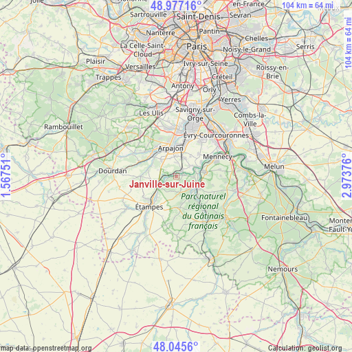
Janville-sur-Juine GPS coordinates[2]
48° 30' 48.672" North, 2° 16' 14.304" East
| Map corner | latitude | longitude |
|---|---|---|
| Upper-left | 48.97716°, | 1.56751° |
| Center: | 48.51352°, | 2.27064° |
| Lower-right: | 48.0456°, | 2.97376° |
| Map W x H: | 103.6×103.6 km | = 64.4×64.4mi |
| max Lat: | 51.07786° ⇑31.4% North |
| Janville-sur-Juine: | 48.51352° |
| min Lat: | ⇓68.6% South 41.3874° |
| min Long | Janville-sur-Ju | max Long |
| -5.08615° | 2.27064° | 9.52242° |
| W 46.8%⇐ | ⇒53.2% E |
Elevation
Elevation of Janville-sur-Juine is 95 m = 312 ft, and this is 98.7 m = 324 ft below average elevation for this country.
| Max E: |
2333 m = 7654 ft | 62.8% |
| Avg. | 193.7 m = 635 ft | |
| Janville-sur-Juine | 95 m = 312 ft | |
Min E: |
-1 m = -3 ft | 37.2% |
See also: France elevation on elevation.city.
Geographical zone
Janville-sur-Juine is located in North temperate zone (between Tropic of Cancer and the Arctic Circle). Distance of this North polar circle is 2007 km =1247.1 mi to North.| Distance of | km | miles | from Janville-sur-Juine |
|---|---|---|---|
| North Pole | 4612.9 | 2866.3 | to North |
| Arctic Circle | 2007 | 1247.1 | to North |
| Tropic Cancer | 2788.3 | 1732.6 | to South |
| Equator | 5394.2 | 3351.8 | to South |


Nearby cities:
15 places around Janville-sur-Juine: (largest is in red/bold)
• Auvers-Saint-Georges
4.4 km =2.7 mi,  238°
238°
• Avrainville
5.8 km =3.6 mi,  341°
341°
• Boissy-le-Cutté
4.9 km =3 mi,  169°
169°
• Boissy-sous-Saint-Yon
6.2 km =3.9 mi,  316°
316°
• Bouray-sur-Juine
2.3 km =1.4 mi,  72°
72°
• Cerny
5.8 km =3.6 mi,  133°
133°
• Chamarande
4 km =2.5 mi,  275°
275°
• Cheptainville
4.2 km =2.6 mi,  6°
6°
• Guibeville
6.3 km =3.9 mi,  0°
0°
• Itteville
5.4 km =3.4 mi,  87°
87°
• Lardy
0.6 km =0.4 mi,  21°
21°
• Marolles-en-Hurepoix
5.8 km =3.6 mi, 20°
• Saint-Vrain
5.7 km =3.5 mi,  54°
54°
• Villeneuve-sur-Auvers
4.6 km =2.9 mi,  201°
201°
• Étréchy
6 km =3.7 mi,  249°
249°
Sources, notices
• [Note1] Compared only with cities in France existing in our database
• [Src1] Map data: © OpenStreetMap contributors (CC-BY-SA)
• [Src2] Other city data from geonames.org with taken over terms of usage.
• [Src3] Geographical zone / Annual Mean Temperature by Robert A. Rohde @ Wikipedia
