Essert geodata
Essert (Bourgogne-Franche-Comté) is a populated place; located in France in Europe/Paris (GMT+2) time zone. With population of 2,891 people, there are 3371 cities with bigger population in this country. Compared to other cities in France, 53.2% of cities are located further ↓South; 93.7% of cities are located further ←West and 88.3% of cities have lower elevation than Essert. Note1
Administrative division(s):
- Level 1: Bourgogne-Franche-Comté
- Level 2: Territoire de Belfort
- Level 3: Arrondissement de Belfort
- Level 4: Essert


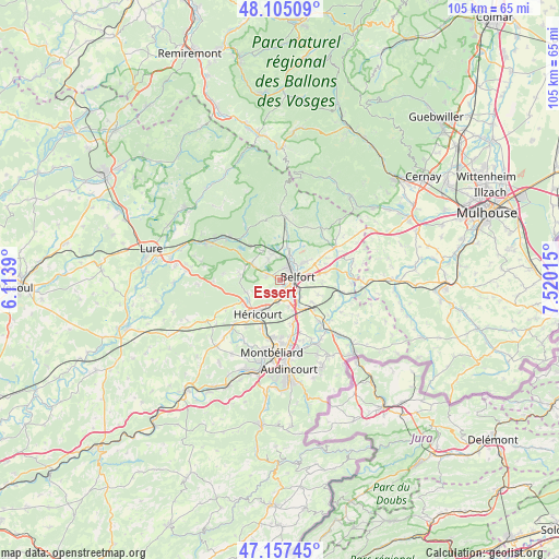
Essert GPS coordinates[2]
47° 38' 0.312" North, 6° 49' 1.272" East
| Map corner | latitude | longitude |
|---|---|---|
| Upper-left | 48.10509°, | 6.1139° |
| Center: | 47.63342°, | 6.81702° |
| Lower-right: | 47.15745°, | 7.52015° |
| Map W x H: | 105.4×105.4 km | = 65.5×65.5mi |
| max Lat: | 51.07786° ⇑46.8% North |
| Essert: | 47.63342° |
| min Lat: | ⇓53.2% South 41.3874° |
| min Long | Essert | max Long |
| -5.08615° | 6.81702° | 9.52242° |
| W 93.7%⇐ | ⇒6.3% E |
Elevation
Elevation of Essert is 394 m = 1293 ft, and this is 200.3 m = 657 ft above average elevation for this country.
| Max E: |
2333 m = 7654 ft | 11.7% |
| Essert | 394 m 1293 ft | |
| Avg. | 193.7 m = 635 ft | |
Min E: |
-1 m = -3 ft | 88.3% |
See also: France elevation on elevation.city.
Geographical zone
Essert is located in North temperate zone (between Tropic of Cancer and the Arctic Circle). Distance of this North polar circle is 2104.8 km =1307.9 mi to North.| Distance of | km | miles | from Essert |
|---|---|---|---|
| North Pole | 4710.7 | 2927.1 | to North |
| Arctic Circle | 2104.8 | 1307.9 | to North |
| Tropic Cancer | 2690.4 | 1671.7 | to South |
| Equator | 5296.3 | 3291 | to South |


Nearby cities:
15 places around Essert: (largest is in red/bold)
• Andelnans
5 km =3.1 mi,  132°
132°
• Bavilliers
1.8 km =1.1 mi, 131°
• Belfort
2.9 km =1.8 mi,  70°
70°
• Brevilliers
6 km =3.7 mi,  199°
199°
• Châlonvillars
2.6 km =1.6 mi,  287°
287°
• Cravanche
2.5 km =1.6 mi,  26°
26°
• Danjoutin
3.8 km =2.4 mi,  116°
116°
• Dorans
5.2 km =3.2 mi,  162°
162°
• Frahier-et-Chatebier
6.2 km =3.9 mi,  306°
306°
• Offemont
5.6 km =3.5 mi,  54°
54°
• Pérouse
5.6 km =3.5 mi,  86°
86°
• Salbert
4 km =2.5 mi,  355°
355°
• Sermamagny
6.6 km =4.1 mi,  13°
13°
• Sevenans
6.4 km =4 mi,  144°
144°
• Valdoie
4.5 km =2.8 mi,  24°
24°
Sources, notices
• [Note1] Compared only with cities in France existing in our database
• [Src1] Map data: © OpenStreetMap contributors (CC-BY-SA)
• [Src2] Other city data from geonames.org with taken over terms of usage.
• [Src3] Geographical zone / Annual Mean Temperature by Robert A. Rohde @ Wikipedia
