Cravanche geodata
Cravanche (Bourgogne-Franche-Comté) is a populated place; located in France in Europe/Paris (GMT+2) time zone. With population of 1,947 people, there are 4918 cities with bigger population in this country. Compared to other cities in France, 53.5% of cities are located further ↓South; 93.8% of cities are located further ←West and 87% of cities have lower elevation than Cravanche. Note1
Administrative division(s):
- Level 1: Bourgogne-Franche-Comté
- Level 2: Territoire de Belfort
- Level 3: Arrondissement de Belfort
- Level 4: Cravanche


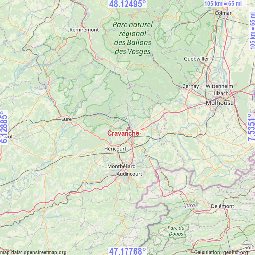
Cravanche GPS coordinates[2]
47° 39' 12.456" North, 6° 49' 55.092" East
| Map corner | latitude | longitude |
|---|---|---|
| Upper-left | 48.12495°, | 6.12885° |
| Center: | 47.65346°, | 6.83197° |
| Lower-right: | 47.17768°, | 7.5351° |
| Map W x H: | 105.3×105.3 km | = 65.4×65.4mi |
| max Lat: | 51.07786° ⇑46.5% North |
| Cravanche: | 47.65346° |
| min Lat: | ⇓53.5% South 41.3874° |
| min Long | Cravanche | max Long |
| -5.08615° | 6.83197° | 9.52242° |
| W 93.8%⇐ | ⇒6.2% E |
Elevation
Elevation of Cravanche is 374 m = 1227 ft, and this is 180.3 m = 592 ft above average elevation for this country.
| Max E: |
2333 m = 7654 ft | 13% |
| Cravanche | 374 m 1227 ft | |
| Avg. | 193.7 m = 635 ft | |
Min E: |
-1 m = -3 ft | 87% |
See also: France elevation on elevation.city.
Geographical zone
Cravanche is located in North temperate zone (between Tropic of Cancer and the Arctic Circle). Distance of this North polar circle is 2102.6 km =1306.5 mi to North.| Distance of | km | miles | from Cravanche |
|---|---|---|---|
| North Pole | 4708.5 | 2925.7 | to North |
| Arctic Circle | 2102.6 | 1306.5 | to North |
| Tropic Cancer | 2692.6 | 1673.1 | to South |
| Equator | 5298.6 | 3292.4 | to South |


Nearby cities:
15 places around Cravanche: (largest is in red/bold)
• Andelnans
6.2 km =3.9 mi,  155°
155°
• Bavilliers
3.5 km =2.2 mi,  175°
175°
• Belfort
2.1 km =1.3 mi,  127°
127°
• Châlonvillars
3.9 km =2.4 mi,  248°
248°
• Danjoutin
4.5 km =2.8 mi,  150°
150°
• Denney
6.5 km =4 mi,  83°
83°
• Essert
2.5 km =1.6 mi,  206°
206°
• Frahier-et-Chatebier
6.3 km =3.9 mi,  283°
283°
• Lachapelle-sous-Chaux
5.8 km =3.6 mi,  351°
351°
• Offemont
3.6 km =2.2 mi,  73°
73°
• Pérouse
4.8 km =3 mi,  112°
112°
• Salbert
2.3 km =1.4 mi,  321°
321°
• Sermamagny
4.2 km =2.6 mi,  4°
4°
• Valdoie
2 km =1.2 mi,  21°
21°
• Éloie
5.1 km =3.2 mi,  37°
37°
Sources, notices
• [Note1] Compared only with cities in France existing in our database
• [Src1] Map data: © OpenStreetMap contributors (CC-BY-SA)
• [Src2] Other city data from geonames.org with taken over terms of usage.
• [Src3] Geographical zone / Annual Mean Temperature by Robert A. Rohde @ Wikipedia
