Availles-Limouzine geodata
Availles-Limouzine (Nouvelle-Aquitaine) is a populated place; located in France in Europe/Paris (GMT+2) time zone. With population of 1,399 people, there are 6610 cities with bigger population in this country. Compared to other cities in France, 64.8% of cities are located further ↑North; 71.8% of cities are located further →East and 50.1% of cities have lower elevation than Availles-Limouzine. Note1
Administrative division(s):
- Level 1: Nouvelle-Aquitaine
- Level 2: Vienne
- Level 3: Arrondissement de Montmorillon
- Level 4: Availles-Limouzine


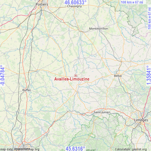
Availles-Limouzine GPS coordinates[2]
46° 7' 16.032" North, 0° 39' 19.044" East
| Map corner | latitude | longitude |
|---|---|---|
| Upper-left | 46.60633°, | -0.04784° |
| Center: | 46.12112°, | 0.65529° |
| Lower-right: | 45.6316°, | 1.35841° |
| Map W x H: | 108.4×108.4 km | = 67.4×67.4mi |
| max Lat: | 51.07786° ⇑64.8% North |
| Availles-Limouzine: | 46.12112° |
| min Lat: | ⇓35.2% South 41.3874° |
| min Long | Availles-Limouz | max Long |
| -5.08615° | 0.65529° | 9.52242° |
| W 28.2%⇐ | ⇒71.8% E |
Elevation
Elevation of Availles-Limouzine is 132 m = 433 ft, and this is 61.7 m = 202 ft below average elevation for this country.
| Max E: |
2333 m = 7654 ft | 49.9% |
| Avg. | 193.7 m = 635 ft | |
| Availles-Limouzine | 132 m = 433 ft | |
Min E: |
-1 m = -3 ft | 50.1% |
See also: France elevation on elevation.city.
Geographical zone
Availles-Limouzine is located in North temperate zone (between Tropic of Cancer and the Arctic Circle). Distance of this North polar circle is 2273 km =1412.4 mi to North.| Distance of | km | miles | from Availles-Limouzine |
|---|---|---|---|
| North Pole | 4878.9 | 3031.6 | to North |
| Arctic Circle | 2273 | 1412.4 | to North |
| Tropic Cancer | 2522.3 | 1567.3 | to South |
| Equator | 5128.2 | 3186.5 | to South |


Nearby cities:
15 places around Availles-Limouzine: (largest is in red/bold)
• Adriers
18.8 km =11.7 mi,  36°
36°
• Alloue
14.5 km =9 mi,  227°
227°
• Ansac-sur-Vienne
14.3 km =8.9 mi,  183°
183°
• Brillac
11.6 km =7.2 mi,  125°
125°
• Charroux
19.6 km =12.2 mi,  277°
277°
• Confolens
12 km =7.5 mi,  173°
173°
• Esse
11.2 km =7 mi,  152°
152°
• Le Vigeant
11.5 km =7.1 mi,  357°
357°
• Lessac
6 km =3.7 mi, 165°
• Mauprévoir
12.1 km =7.5 mi,  298°
298°
• Millac
8 km =5 mi,  17°
17°
• Moussac
17.9 km =11.1 mi,  7°
7°
• Payroux
16.8 km =10.4 mi,  308°
308°
• Pressac
6.6 km =4.1 mi,  265°
265°
• Saint-Maurice-des-Lions
17.8 km =11.1 mi, 168°
Sources, notices
• [Note1] Compared only with cities in France existing in our database
• [Src1] Map data: © OpenStreetMap contributors (CC-BY-SA)
• [Src2] Other city data from geonames.org with taken over terms of usage.
• [Src3] Geographical zone / Annual Mean Temperature by Robert A. Rohde @ Wikipedia
