Erbrée geodata
Erbrée (Brittany) is a populated place; located in France in Europe/Paris (GMT+2) time zone. With population of 1,655 people, there are 5649 cities with bigger population in this country. Compared to other cities in France, 61.1% of cities are located further ↓South; 89.4% of cities are located further →East and 53.8% of cities have higher elevation than Erbrée. Note1
Administrative division(s):
- Level 1: Brittany
- Level 2: Département d'Ille-et-Vilaine
- Level 3: Arrondissement de Fougères-Vitré
- Level 4: Erbrée


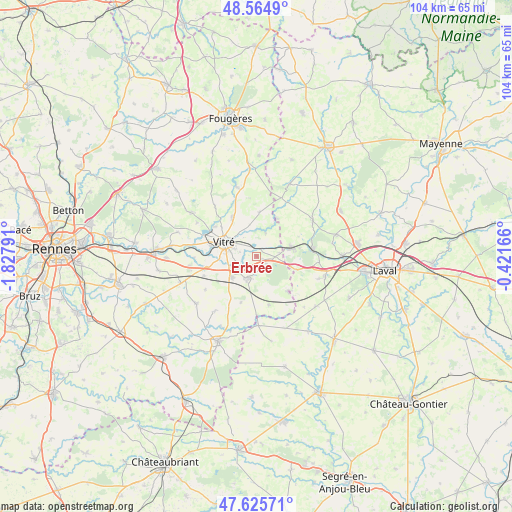
Erbrée GPS coordinates[2]
48° 5' 50.82" North, 1° 7' 29.244" West
| Map corner | latitude | longitude |
|---|---|---|
| Upper-left | 48.5649°, | -1.82791° |
| Center: | 48.09745°, | -1.12479° |
| Lower-right: | 47.62571°, | -0.42166° |
| Map W x H: | 104.4×104.4 km | = 64.9×64.9mi |
| max Lat: | 51.07786° ⇑38.9% North |
| Erbrée: | 48.09745° |
| min Lat: | ⇓61.1% South 41.3874° |
| min Long | Erbrée | max Long |
| -5.08615° | -1.12479° | 9.52242° |
| W 10.6%⇐ | ⇒89.4% E |
Elevation
Elevation of Erbrée is 120 m = 394 ft, and this is 73.7 m = 242 ft below average elevation for this country.
| Max E: |
2333 m = 7654 ft | 53.8% |
| Avg. | 193.7 m = 635 ft | |
| Erbrée | 120 m = 394 ft | |
Min E: |
-1 m = -3 ft | 46.2% |
See also: France elevation on elevation.city.
Geographical zone
Erbrée is located in North temperate zone (between Tropic of Cancer and the Arctic Circle). Distance of this North polar circle is 2053.2 km =1275.8 mi to North.| Distance of | km | miles | from Erbrée |
|---|---|---|---|
| North Pole | 4659.1 | 2895 | to North |
| Arctic Circle | 2053.2 | 1275.8 | to North |
| Tropic Cancer | 2742 | 1703.8 | to South |
| Equator | 5347.9 | 3323 | to South |


Nearby cities:
15 places around Erbrée: (largest is in red/bold)
• Argentré-du-Plessis
4.8 km =3 mi,  199°
199°
• Balazé
9.3 km =5.8 mi,  327°
327°
• Bourgon
8.8 km =5.5 mi,  29°
29°
• Brielles
10.2 km =6.3 mi,  165°
165°
• Bréal-sous-Vitré
4.8 km =3 mi,  82°
82°
• La Gravelle
8.5 km =5.3 mi,  108°
108°
• Le Pertre
9.6 km =6 mi,  137°
137°
• Mondevert
2.4 km =1.5 mi,  130°
130°
• Montreuil-sous-Pérouse
10.4 km =6.5 mi,  305°
305°
• Pocé-les-Bois
9.7 km =6 mi,  282°
282°
• Saint-Cyr-le-Gravelais
10.1 km =6.3 mi, 133°
• Saint-Germain-du-Pinel
10 km =6.2 mi, 198°
• Saint-Pierre-la-Cour
7.6 km =4.7 mi, 77°
• Vitré
6.4 km =4 mi,  290°
290°
• Étrelles
6.6 km =4.1 mi,  231°
231°
Sources, notices
• [Note1] Compared only with cities in France existing in our database
• [Src1] Map data: © OpenStreetMap contributors (CC-BY-SA)
• [Src2] Other city data from geonames.org with taken over terms of usage.
• [Src3] Geographical zone / Annual Mean Temperature by Robert A. Rohde @ Wikipedia
