Mondevert geodata
Mondevert (Brittany) is a populated place; located in France in Europe/Paris (GMT+2) time zone. With population of 691 people, there are 11929 cities with bigger population in this country. Compared to other cities in France, 60.9% of cities are located further ↓South; 89.1% of cities are located further →East and 52% of cities have higher elevation than Mondevert. Note1
Administrative division(s):
- Level 1: Brittany
- Level 2: Département d'Ille-et-Vilaine
- Level 3: Arrondissement de Fougères-Vitré
- Level 4: Mondevert


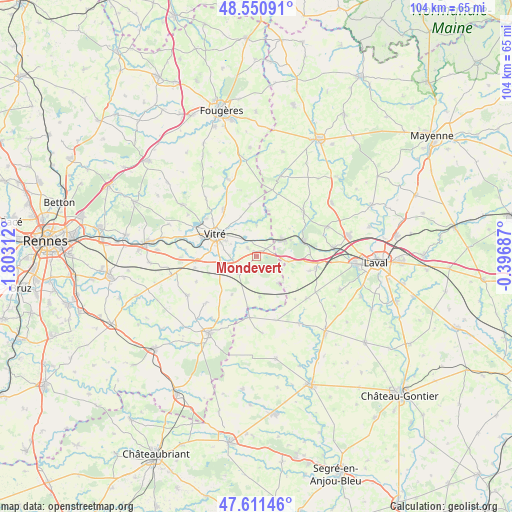
Mondevert GPS coordinates[2]
48° 4' 59.988" North, 1° 6' 0" West
| Map corner | latitude | longitude |
|---|---|---|
| Upper-left | 48.55091°, | -1.80312° |
| Center: | 48.08333°, | -1.1° |
| Lower-right: | 47.61146°, | -0.39687° |
| Map W x H: | 104.5×104.5 km | = 64.9×64.9mi |
| max Lat: | 51.07786° ⇑39.1% North |
| Mondevert: | 48.08333° |
| min Lat: | ⇓60.9% South 41.3874° |
| min Long | Mondevert | max Long |
| -5.08615° | -1.1° | 9.52242° |
| W 10.9%⇐ | ⇒89.1% E |
Elevation
Elevation of Mondevert is 125 m = 410 ft, and this is 68.7 m = 225 ft below average elevation for this country.
| Max E: |
2333 m = 7654 ft | 52% |
| Avg. | 193.7 m = 635 ft | |
| Mondevert | 125 m = 410 ft | |
Min E: |
-1 m = -3 ft | 48% |
See also: France elevation on elevation.city.
Geographical zone
Mondevert is located in North temperate zone (between Tropic of Cancer and the Arctic Circle). Distance of this North polar circle is 2054.8 km =1276.8 mi to North.| Distance of | km | miles | from Mondevert |
|---|---|---|---|
| North Pole | 4660.7 | 2896 | to North |
| Arctic Circle | 2054.8 | 1276.8 | to North |
| Tropic Cancer | 2740.4 | 1702.8 | to South |
| Equator | 5346.4 | 3322.1 | to South |


Nearby cities:
15 places around Mondevert: (largest is in red/bold)
• Argentré-du-Plessis
4.5 km =2.8 mi,  229°
229°
• Bourgon
9.6 km =6 mi,  14°
14°
• Brielles
8.4 km =5.2 mi,  174°
174°
• Bréal-sous-Vitré
3.6 km =2.2 mi,  52°
52°
• Erbrée
2.4 km =1.5 mi,  310°
310°
• Gennes-sur-Seiche
10.7 km =6.6 mi,  189°
189°
• La Brûlatte
10.8 km =6.7 mi,  88°
88°
• La Gravelle
6.3 km =3.9 mi,  100°
100°
• Le Pertre
7.2 km =4.5 mi,  139°
139°
• Port-Brillet
10.2 km =6.3 mi,  70°
70°
• Saint-Cyr-le-Gravelais
7.7 km =4.8 mi,  134°
134°
• Saint-Germain-du-Pinel
9.3 km =5.8 mi,  212°
212°
• Saint-Pierre-la-Cour
6.5 km =4 mi,  59°
59°
• Vitré
8.7 km =5.4 mi,  295°
295°
• Étrelles
7.4 km =4.6 mi,  249°
249°
Sources, notices
• [Note1] Compared only with cities in France existing in our database
• [Src1] Map data: © OpenStreetMap contributors (CC-BY-SA)
• [Src2] Other city data from geonames.org with taken over terms of usage.
• [Src3] Geographical zone / Annual Mean Temperature by Robert A. Rohde @ Wikipedia
