Bourgon geodata
Bourgon (Pays de la Loire) is a populated place; located in France in Europe/Paris (GMT+2) time zone. With population of 612 people, there are 13126 cities with bigger population in this country. Compared to other cities in France, 62.2% of cities are located further ↓South; 88.9% of cities are located further →East and 51.2% of cities have higher elevation than Bourgon. Note1
Administrative division(s):
- Level 1: Pays de la Loire
- Level 2: Mayenne
- Level 3: Arrondissement de Laval
- Level 4: Bourgon


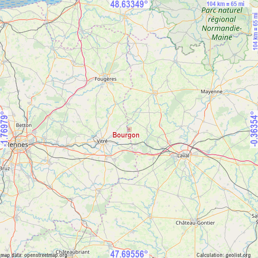
Bourgon GPS coordinates[2]
48° 10' 0.012" North, 1° 4' 0.012" West
| Map corner | latitude | longitude |
|---|---|---|
| Upper-left | 48.63349°, | -1.76979° |
| Center: | 48.16667°, | -1.06667° |
| Lower-right: | 47.69556°, | -0.36354° |
| Map W x H: | 104.3×104.3 km | = 64.8×64.8mi |
| max Lat: | 51.07786° ⇑37.8% North |
| Bourgon: | 48.16667° |
| min Lat: | ⇓62.2% South 41.3874° |
| min Long | Bourgon | max Long |
| -5.08615° | -1.06667° | 9.52242° |
| W 11.1%⇐ | ⇒88.9% E |
Elevation
Elevation of Bourgon is 128 m = 420 ft, and this is 65.7 m = 216 ft below average elevation for this country.
| Max E: |
2333 m = 7654 ft | 51.2% |
| Avg. | 193.7 m = 635 ft | |
| Bourgon | 128 m = 420 ft | |
Min E: |
-1 m = -3 ft | 48.8% |
See also: France elevation on elevation.city.
Geographical zone
Bourgon is located in North temperate zone (between Tropic of Cancer and the Arctic Circle). Distance of this North polar circle is 2045.5 km =1271 mi to North.| Distance of | km | miles | from Bourgon |
|---|---|---|---|
| North Pole | 4651.4 | 2890.2 | to North |
| Arctic Circle | 2045.5 | 1271 | to North |
| Tropic Cancer | 2749.7 | 1708.6 | to South |
| Equator | 5355.6 | 3327.8 | to South |


Nearby cities:
15 places around Bourgon: (largest is in red/bold)
• Balazé
9.3 km =5.8 mi,  270°
270°
• Bréal-sous-Vitré
7.1 km =4.4 mi,  176°
176°
• Châtillon-en-Vendelais
10.4 km =6.5 mi,  307°
307°
• Erbrée
8.8 km =5.5 mi,  209°
209°
• Juvigné
7.3 km =4.5 mi,  19°
19°
• La Brûlatte
12.3 km =7.6 mi,  137°
137°
• La Croixille
4.3 km =2.7 mi,  8°
8°
• La Gravelle
11.1 km =6.9 mi,  160°
160°
• Le Bourgneuf-la-Forêt
7.2 km =4.5 mi,  93°
93°
• Mondevert
9.6 km =6 mi,  194°
194°
• Port-Brillet
9.3 km =5.8 mi,  129°
129°
• Saint-Hilaire-du-Maine
12.1 km =7.5 mi,  56°
56°
• Saint-Pierre-des-Landes
12.3 km =7.6 mi, 13°
• Saint-Pierre-la-Cour
6.8 km =4.2 mi,  152°
152°
• Vitré
11.7 km =7.3 mi,  242°
242°
Sources, notices
• [Note1] Compared only with cities in France existing in our database
• [Src1] Map data: © OpenStreetMap contributors (CC-BY-SA)
• [Src2] Other city data from geonames.org with taken over terms of usage.
• [Src3] Geographical zone / Annual Mean Temperature by Robert A. Rohde @ Wikipedia
