Dolus-le-Sec geodata
Dolus-le-Sec (Centre) is a populated place; located in France in Europe/Paris (GMT+2) time zone. With population of 562 people, there are 13969 cities with bigger population in this country. Compared to other cities in France, 53.5% of cities are located further ↑North; 69.8% of cities are located further →East and 57.3% of cities have higher elevation than Dolus-le-Sec. Note1
Administrative division(s):
- Level 1: Centre
- Level 2: Département d'Indre-et-Loire
- Level 3: Arrondissement de Loches
- Level 4: Dolus-le-Sec


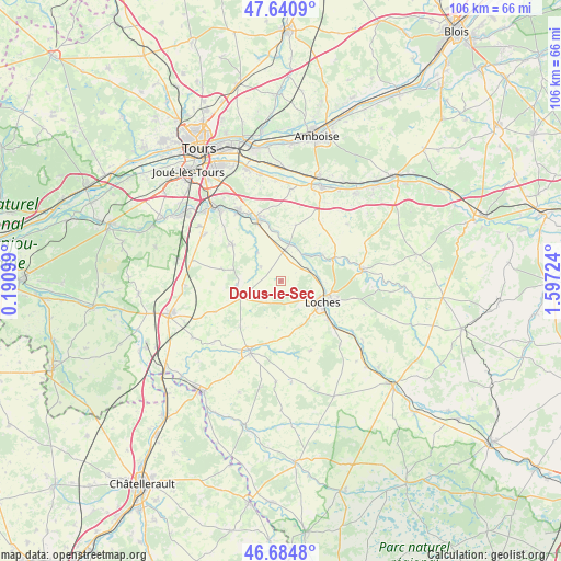
Dolus-le-Sec GPS coordinates[2]
47° 9' 54" North, 0° 53' 38.796" East
| Map corner | latitude | longitude |
|---|---|---|
| Upper-left | 47.6409°, | 0.19099° |
| Center: | 47.165°, | 0.89411° |
| Lower-right: | 46.6848°, | 1.59724° |
| Map W x H: | 106.3×106.3 km | = 66.1×66.1mi |
| max Lat: | 51.07786° ⇑53.5% North |
| Dolus-le-Sec: | 47.165° |
| min Lat: | ⇓46.5% South 41.3874° |
| min Long | Dolus-le-Sec | max Long |
| -5.08615° | 0.89411° | 9.52242° |
| W 30.2%⇐ | ⇒69.8% E |
Elevation
Elevation of Dolus-le-Sec is 110 m = 361 ft, and this is 83.7 m = 275 ft below average elevation for this country.
| Max E: |
2333 m = 7654 ft | 57.3% |
| Avg. | 193.7 m = 635 ft | |
| Dolus-le-Sec | 110 m = 361 ft | |
Min E: |
-1 m = -3 ft | 42.7% |
See also: France elevation on elevation.city.
Geographical zone
Dolus-le-Sec is located in North temperate zone (between Tropic of Cancer and the Arctic Circle). Distance of this North polar circle is 2156.9 km =1340.2 mi to North.| Distance of | km | miles | from Dolus-le-Sec |
|---|---|---|---|
| North Pole | 4762.8 | 2959.5 | to North |
| Arctic Circle | 2156.9 | 1340.2 | to North |
| Tropic Cancer | 2638.3 | 1639.4 | to South |
| Equator | 5244.3 | 3258.7 | to South |


Nearby cities:
15 places around Dolus-le-Sec: (largest is in red/bold)
• Beaulieu-lès-Loches
10.2 km =6.3 mi,  115°
115°
• Chambourg-sur-Indre
5.9 km =3.7 mi,  71°
71°
• Cormery
12.3 km =7.6 mi,  338°
338°
• Courçay
9.8 km =6.1 mi,  352°
352°
• Ferrière-sur-Beaulieu
11.3 km =7 mi,  105°
105°
• La Chapelle-Blanche-Saint-Martin
11.7 km =7.3 mi,  221°
221°
• Loches
8.7 km =5.4 mi, 117°
• Louans
11.3 km =7 mi,  281°
281°
• Manthelan
8.3 km =5.2 mi,  247°
247°
• Perrusson
11.7 km =7.3 mi,  129°
129°
• Reignac-sur-Indre
7 km =4.3 mi,  13°
13°
• Saint-Branchs
11.4 km =7.1 mi,  306°
306°
• Saint-Jean-Saint-Germain
14 km =8.7 mi, 130°
• Tauxigny
7 km =4.3 mi,  320°
320°
• Truyes
12.4 km =7.7 mi, 345°
Sources, notices
• [Note1] Compared only with cities in France existing in our database
• [Src1] Map data: © OpenStreetMap contributors (CC-BY-SA)
• [Src2] Other city data from geonames.org with taken over terms of usage.
• [Src3] Geographical zone / Annual Mean Temperature by Robert A. Rohde @ Wikipedia
