Dingsheim geodata
Dingsheim (Grand Est) is a populated place; located in France in Europe/Paris (GMT+2) time zone. With population of 1,134 people, there are 7917 cities with bigger population in this country. Compared to other cities in France, 71.6% of cities are located further ↓South; 98.9% of cities are located further ←West and 56.3% of cities have lower elevation than Dingsheim. Note1
Administrative division(s):
- Level 1: Grand Est
- Level 2: Bas-Rhin
- Level 3: Arrondissement de Saverne
- Level 4: Dingsheim


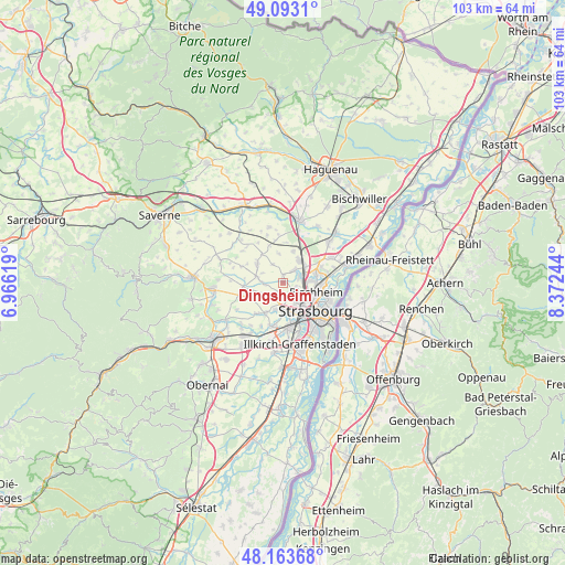
Dingsheim GPS coordinates[2]
48° 37' 49.908" North, 7° 40' 9.552" East
| Map corner | latitude | longitude |
|---|---|---|
| Upper-left | 49.0931°, | 6.96619° |
| Center: | 48.63053°, | 7.66932° |
| Lower-right: | 48.16368°, | 8.37244° |
| Map W x H: | 103.3×103.3 km | = 64.2×64.2mi |
| max Lat: | 51.07786° ⇑28.4% North |
| Dingsheim: | 48.63053° |
| min Lat: | ⇓71.6% South 41.3874° |
| min Long | Dingsheim | max Long |
| -5.08615° | 7.66932° | 9.52242° |
| W 98.9%⇐ | ⇒1.1% E |
Elevation
Elevation of Dingsheim is 155 m = 509 ft, and this is 38.7 m = 127 ft below average elevation for this country.
| Max E: |
2333 m = 7654 ft | 43.7% |
| Avg. | 193.7 m = 635 ft | |
| Dingsheim | 155 m = 509 ft | |
Min E: |
-1 m = -3 ft | 56.3% |
See also: France elevation on elevation.city.
Geographical zone
Dingsheim is located in North temperate zone (between Tropic of Cancer and the Arctic Circle). Distance of this North polar circle is 1994 km =1239 mi to North.| Distance of | km | miles | from Dingsheim |
|---|---|---|---|
| North Pole | 4599.9 | 2858.2 | to North |
| Arctic Circle | 1994 | 1239 | to North |
| Tropic Cancer | 2801.3 | 1740.6 | to South |
| Equator | 5407.2 | 3359.9 | to South |


Nearby cities:
15 places around Dingsheim: (largest is in red/bold)
• Berstett
5.5 km =3.4 mi,  350°
350°
• Griesheim-sur-Souffel
0.6 km =0.4 mi,  359°
359°
• Lampertheim
3.2 km =2 mi,  42°
42°
• Mittelhausbergen
2.4 km =1.5 mi,  139°
139°
• Mundolsheim
3.5 km =2.2 mi,  68°
68°
• Niederhausbergen
2.5 km =1.6 mi,  106°
106°
• Oberhausbergen
3.1 km =1.9 mi,  152°
152°
• Oberschaeffolsheim
5.1 km =3.2 mi,  196°
196°
• Offenheim
3.9 km =2.4 mi,  272°
272°
• Pfettisheim
3.7 km =2.3 mi,  331°
331°
• Pfulgriesheim
1.5 km =0.9 mi,  4°
4°
• Souffelweyersheim
5.3 km =3.3 mi,  84°
84°
• Vendenheim
5.3 km =3.3 mi,  34°
34°
• Wiwersheim
4.7 km =2.9 mi,  282°
282°
• Wolfisheim
4.8 km =3 mi,  181°
181°
Sources, notices
• [Note1] Compared only with cities in France existing in our database
• [Src1] Map data: © OpenStreetMap contributors (CC-BY-SA)
• [Src2] Other city data from geonames.org with taken over terms of usage.
• [Src3] Geographical zone / Annual Mean Temperature by Robert A. Rohde @ Wikipedia
