Souffelweyersheim geodata
Souffelweyersheim (Grand Est) is a populated place; located in France in Europe/Paris (GMT+2) time zone. With population of 6,344 people, there are 1561 cities with bigger population in this country. Compared to other cities in France, 71.7% of cities are located further ↓South; 99.1% of cities are located further ←West and 52.8% of cities have lower elevation than Souffelweyersheim. Note1
Administrative division(s):
- Level 1: Grand Est
- Level 2: Bas-Rhin
- Level 3: Arrondissement de Strasbourg
- Level 4: Souffelweyersheim


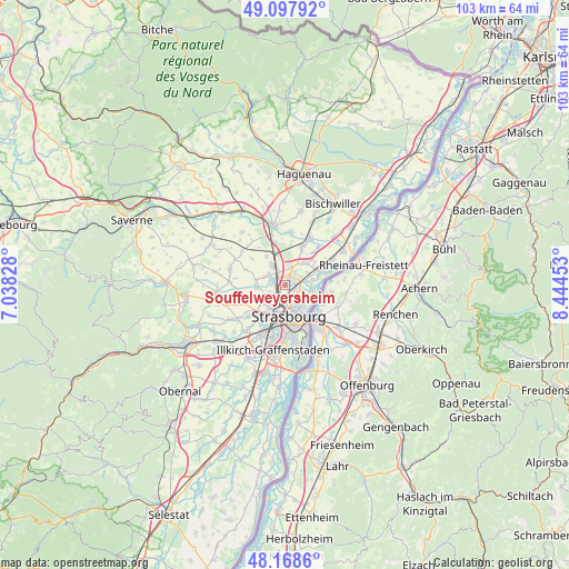
Souffelweyersheim GPS coordinates[2]
48° 38' 7.44" North, 7° 44' 29.076" East
| Map corner | latitude | longitude |
|---|---|---|
| Upper-left | 49.09792°, | 7.03828° |
| Center: | 48.6354°, | 7.74141° |
| Lower-right: | 48.1686°, | 8.44453° |
| Map W x H: | 103.3×103.3 km | = 64.2×64.2mi |
| max Lat: | 51.07786° ⇑28.3% North |
| Souffelweyersheim: | 48.6354° |
| min Lat: | ⇓71.7% South 41.3874° |
| min Long | Souffelweyershe | max Long |
| -5.08615° | 7.74141° | 9.52242° |
| W 99.1%⇐ | ⇒0.90000000000001% E |
Elevation
Elevation of Souffelweyersheim is 142 m = 466 ft, and this is 51.7 m = 170 ft below average elevation for this country.
| Max E: |
2333 m = 7654 ft | 47.2% |
| Avg. | 193.7 m = 635 ft | |
| Souffelweyersheim | 142 m = 466 ft | |
Min E: |
-1 m = -3 ft | 52.8% |
See also: France elevation on elevation.city.
Geographical zone
Souffelweyersheim is located in North temperate zone (between Tropic of Cancer and the Arctic Circle). Distance of this North polar circle is 1993.4 km =1238.6 mi to North.| Distance of | km | miles | from Souffelweyersheim |
|---|---|---|---|
| North Pole | 4599.3 | 2857.9 | to North |
| Arctic Circle | 1993.4 | 1238.6 | to North |
| Tropic Cancer | 2801.8 | 1741 | to South |
| Equator | 5407.7 | 3360.2 | to South |


Nearby cities:
15 places around Souffelweyersheim: (largest is in red/bold)
• Bischheim
2.3 km =1.4 mi,  157°
157°
• Dingsheim
5.3 km =3.3 mi,  264°
264°
• Eckwersheim
6.1 km =3.8 mi,  327°
327°
• Griesheim-sur-Souffel
5.3 km =3.3 mi,  270°
270°
• Hœnheim
1.8 km =1.1 mi,  144°
144°
• Lampertheim
3.6 km =2.2 mi,  299°
299°
• Mittelhausbergen
4.4 km =2.7 mi,  238°
238°
• Mundolsheim
2.2 km =1.4 mi,  290°
290°
• Niederhausbergen
3.2 km =2 mi,  246°
246°
• Oberhausbergen
5.1 km =3.2 mi,  230°
230°
• Pfulgriesheim
5.3 km =3.3 mi,  280°
280°
• Reichstett
1.8 km =1.1 mi,  33°
33°
• Schiltigheim
3.2 km =2 mi,  169°
169°
• Strasbourg
5.7 km =3.5 mi,  176°
176°
• Vendenheim
4.4 km =2.7 mi, 328°
Sources, notices
• [Note1] Compared only with cities in France existing in our database
• [Src1] Map data: © OpenStreetMap contributors (CC-BY-SA)
• [Src2] Other city data from geonames.org with taken over terms of usage.
• [Src3] Geographical zone / Annual Mean Temperature by Robert A. Rohde @ Wikipedia
