Châteauneuf-sur-Loire geodata
Châteauneuf-sur-Loire (Centre) is a populated place; located in France in Europe/Paris (GMT+2) time zone. With population of 7,446 people, there are 1311 cities with bigger population in this country. Compared to other cities in France, 56.9% of cities are located further ↓South; 54.1% of cities are located further →East and 53.1% of cities have higher elevation than Châteauneuf-sur-Loire. Note1
Administrative division(s):
- Level 1: Centre
- Level 2: Loiret
- Level 3: Arrondissement d’Orléans
- Level 4: Châteauneuf-sur-Loire
Current local time in Châteauneuf-sur-Loire:
03:05 AM, WednesdayDifference from your time zone: hours


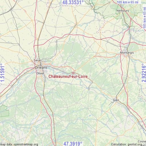
Châteauneuf-sur-Loire GPS coordinates[2]
47° 51' 56.7" North, 2° 13' 8.508" East
| Map corner | latitude | longitude |
|---|---|---|
| Upper-left | 48.33531°, | 1.51591° |
| Center: | 47.86575°, | 2.21903° |
| Lower-right: | 47.3919°, | 2.92216° |
| Map W x H: | 104.9×104.9 km | = 65.2×65.2mi |
| max Lat: | 51.07786° ⇑43.1% North |
| Châteauneuf-sur-Loire: | 47.86575° |
| min Lat: | ⇓56.9% South 41.3874° |
| min Long | Châteauneuf-su | max Long |
| -5.08615° | 2.21903° | 9.52242° |
| W 45.9%⇐ | ⇒54.1% E |
Elevation
Elevation of Châteauneuf-sur-Loire is 122 m = 400 ft, and this is 71.7 m = 235 ft below average elevation for this country.
| Max E: |
2333 m = 7654 ft | 53.1% |
| Avg. | 193.7 m = 635 ft | |
| Châteauneuf-sur-Loire | 122 m = 400 ft | |
Min E: |
-1 m = -3 ft | 46.9% |
See also: France elevation on elevation.city.
Geographical zone
Châteauneuf-sur-Loire is located in North temperate zone (between Tropic of Cancer and the Arctic Circle). Distance of this North polar circle is 2079 km =1291.8 mi to North.| Distance of | km | miles | from Châteauneuf-sur-Loire |
|---|---|---|---|
| North Pole | 4684.9 | 2911.1 | to North |
| Arctic Circle | 2079 | 1291.8 | to North |
| Tropic Cancer | 2716.3 | 1687.8 | to South |
| Equator | 5322.2 | 3307.1 | to South |


Nearby cities:
15 places around Châteauneuf-sur-Loire: (largest is in red/bold)
• Bouzy-la-Forêt
11.9 km =7.4 mi,  97°
97°
• Bray-en-Val
11.8 km =7.3 mi,  110°
110°
• Darvoy
8.9 km =5.5 mi,  264°
264°
• Donnery
10.2 km =6.3 mi,  302°
302°
• Fay-aux-Loges
9 km =5.6 mi,  319°
319°
• Férolles
8.8 km =5.5 mi,  246°
246°
• Germigny-des-Prés
4.4 km =2.7 mi,  121°
121°
• Guilly
8.1 km =5 mi,  148°
148°
• Jargeau
6.9 km =4.3 mi,  267°
267°
• Neuvy-en-Sullias
8.1 km =5 mi,  166°
166°
• Saint-Benoît-sur-Loire
9.7 km =6 mi,  133°
133°
• Sigloy
3.6 km =2.2 mi, 171°
• Tigy
8.2 km =5.1 mi,  191°
191°
• Vienne-en-Val
9.6 km =6 mi,  220°
220°
• Vitry-aux-Loges
8.3 km =5.2 mi,  25°
25°
Sources, notices
• [Note1] Compared only with cities in France existing in our database
• [Src1] Map data: © OpenStreetMap contributors (CC-BY-SA)
• [Src2] Other city data from geonames.org with taken over terms of usage.
• [Src3] Geographical zone / Annual Mean Temperature by Robert A. Rohde @ Wikipedia
