Croissy-Beaubourg geodata
Croissy-Beaubourg (Île-de-France) is a populated place; located in France in Europe/Paris (GMT+2) time zone. With population of 2,135 people, there are 4500 cities with bigger population in this country. Compared to other cities in France, 76.2% of cities are located further ↓South; 53% of cities are located further ←West and 58.7% of cities have higher elevation than Croissy-Beaubourg. Note1
Administrative division(s):
- Level 1: Île-de-France
- Level 2: Seine-et-Marne
- Level 3: Arrondissement de Torcy
- Level 4: Croissy-Beaubourg


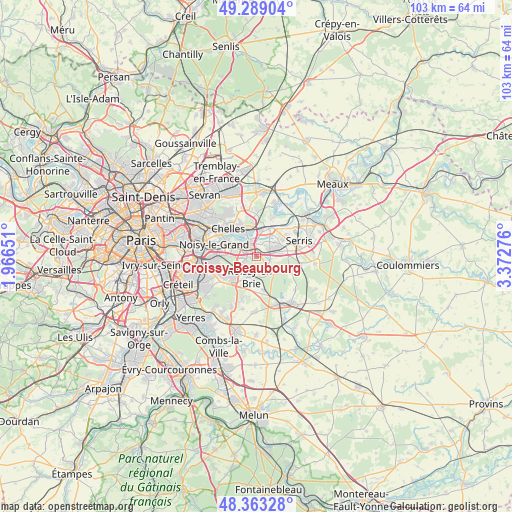
Croissy-Beaubourg GPS coordinates[2]
48° 49' 41.88" North, 2° 40' 10.704" East
| Map corner | latitude | longitude |
|---|---|---|
| Upper-left | 49.28904°, | 1.96651° |
| Center: | 48.8283°, | 2.66964° |
| Lower-right: | 48.36328°, | 3.37276° |
| Map W x H: | 102.9×102.9 km | = 63.9×63.9mi |
| max Lat: | 51.07786° ⇑23.8% North |
| Croissy-Beaubourg: | 48.8283° |
| min Lat: | ⇓76.2% South 41.3874° |
| min Long | Croissy-Beaubou | max Long |
| -5.08615° | 2.66964° | 9.52242° |
| W 53%⇐ | ⇒47% E |
Elevation
Elevation of Croissy-Beaubourg is 106 m = 348 ft, and this is 87.7 m = 288 ft below average elevation for this country.
| Max E: |
2333 m = 7654 ft | 58.7% |
| Avg. | 193.7 m = 635 ft | |
| Croissy-Beaubourg | 106 m = 348 ft | |
Min E: |
-1 m = -3 ft | 41.3% |
See also: France elevation on elevation.city.
Geographical zone
Croissy-Beaubourg is located in North temperate zone (between Tropic of Cancer and the Arctic Circle). Distance of this North polar circle is 1972 km =1225.3 mi to North.| Distance of | km | miles | from Croissy-Beaubourg |
|---|---|---|---|
| North Pole | 4577.9 | 2844.6 | to North |
| Arctic Circle | 1972 | 1225.3 | to North |
| Tropic Cancer | 2823.3 | 1754.3 | to South |
| Equator | 5429.2 | 3373.5 | to South |


Nearby cities:
15 places around Croissy-Beaubourg: (largest is in red/bold)
• Bussy-Saint-Georges
2.7 km =1.7 mi,  58°
58°
• Bussy-Saint-Martin
2.8 km =1.7 mi,  33°
33°
• Collégien
0.9 km =0.6 mi,  19°
19°
• Conches-sur-Gondoire
4.7 km =2.9 mi,  48°
48°
• Ferrières-en-Brie
2.8 km =1.7 mi,  101°
101°
• Gouvernes
3.9 km =2.4 mi, 23°
• Guermantes
3.8 km =2.4 mi,  43°
43°
• Lagny-sur-Marne
5.5 km =3.4 mi, 38°
• Lognes
3 km =1.9 mi,  285°
285°
• Noisiel
4 km =2.5 mi,  304°
304°
• Pontcarré
4.3 km =2.7 mi,  142°
142°
• Roissy-en-Brie
4.4 km =2.7 mi,  201°
201°
• Saint-Thibault-des-Vignes
4.8 km =3 mi,  9°
9°
• Torcy
2.8 km =1.7 mi,  330°
330°
• Émerainville
3.9 km =2.4 mi,  243°
243°
Sources, notices
• [Note1] Compared only with cities in France existing in our database
• [Src1] Map data: © OpenStreetMap contributors (CC-BY-SA)
• [Src2] Other city data from geonames.org with taken over terms of usage.
• [Src3] Geographical zone / Annual Mean Temperature by Robert A. Rohde @ Wikipedia
