Chambry geodata
Chambry (Île-de-France) is a populated place; located in France in Europe/Paris (GMT+2) time zone. With population of 921 people, there are 9479 cities with bigger population in this country. Compared to other cities in France, 79.6% of cities are located further ↓South; 56.3% of cities are located further ←West and 62.4% of cities have higher elevation than Chambry. Note1
Administrative division(s):
- Level 1: Île-de-France
- Level 2: Seine-et-Marne
- Level 3: Arrondissement de Meaux
- Level 4: Chambry


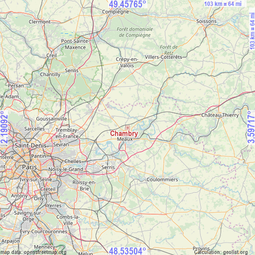
Chambry GPS coordinates[2]
48° 59' 54.528" North, 2° 53' 38.544" East
| Map corner | latitude | longitude |
|---|---|---|
| Upper-left | 49.45765°, | 2.19092° |
| Center: | 48.99848°, | 2.89404° |
| Lower-right: | 48.53504°, | 3.59717° |
| Map W x H: | 102.6×102.6 km | = 63.8×63.8mi |
| max Lat: | 51.07786° ⇑20.4% North |
| Chambry: | 48.99848° |
| min Lat: | ⇓79.6% South 41.3874° |
| min Long | Chambry | max Long |
| -5.08615° | 2.89404° | 9.52242° |
| W 56.3%⇐ | ⇒43.7% E |
Elevation
Elevation of Chambry is 96 m = 315 ft, and this is 97.7 m = 321 ft below average elevation for this country.
| Max E: |
2333 m = 7654 ft | 62.4% |
| Avg. | 193.7 m = 635 ft | |
| Chambry | 96 m = 315 ft | |
Min E: |
-1 m = -3 ft | 37.6% |
See also: France elevation on elevation.city.
Geographical zone
Chambry is located in North temperate zone (between Tropic of Cancer and the Arctic Circle). Distance of this North polar circle is 1953.1 km =1213.6 mi to North.| Distance of | km | miles | from Chambry |
|---|---|---|---|
| North Pole | 4558.9 | 2832.8 | to North |
| Arctic Circle | 1953.1 | 1213.6 | to North |
| Tropic Cancer | 2842.2 | 1766.1 | to South |
| Equator | 5448.1 | 3385.3 | to South |


Nearby cities:
15 places around Chambry: (largest is in red/bold)
• Chauconin-Neufmontiers
4.8 km =3 mi,  222°
222°
• Congis-sur-Thérouanne
6.5 km =4 mi,  88°
88°
• Crégy-lès-Meaux
2.8 km =1.7 mi,  209°
209°
• Fublaines
7.4 km =4.6 mi,  155°
155°
• Iverny
7.6 km =4.7 mi,  272°
272°
• Meaux
4.4 km =2.7 mi,  194°
194°
• Monthyon
5.1 km =3.2 mi,  281°
281°
• Nanteuil-lès-Meaux
7.7 km =4.8 mi,  178°
178°
• Penchard
2.8 km =1.7 mi,  241°
241°
• Poincy
4.5 km =2.8 mi,  136°
136°
• Saint-Soupplets
7.7 km =4.8 mi,  305°
305°
• Trilport
6.2 km =3.9 mi, 138°
• Varreddes
2.5 km =1.6 mi,  78°
78°
• Villenoy
6.8 km =4.2 mi,  201°
201°
• Étrépilly
4.9 km =3 mi,  33°
33°
Sources, notices
• [Note1] Compared only with cities in France existing in our database
• [Src1] Map data: © OpenStreetMap contributors (CC-BY-SA)
• [Src2] Other city data from geonames.org with taken over terms of usage.
• [Src3] Geographical zone / Annual Mean Temperature by Robert A. Rohde @ Wikipedia
