Coutiches geodata
Coutiches (Hauts-de-France) is a populated place; located in France in Europe/Paris (GMT+2) time zone. With population of 2,286 people, there are 4215 cities with bigger population in this country. Compared to other cities in France, 96.9% of cities are located further ↓South; 60.7% of cities are located further ←West and 91.2% of cities have higher elevation than Coutiches. Note1
Administrative division(s):
- Level 1: Hauts-de-France
- Level 2: Nord
- Level 3: Arrondissement de Douai
- Level 4: Coutiches


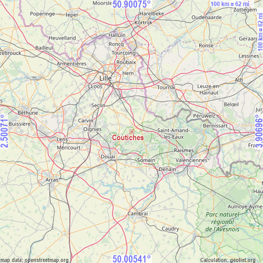
Coutiches GPS coordinates[2]
50° 27' 18.72" North, 3° 12' 13.824" East
| Map corner | latitude | longitude |
|---|---|---|
| Upper-left | 50.90075°, | 2.50071° |
| Center: | 50.4552°, | 3.20384° |
| Lower-right: | 50.00541°, | 3.90696° |
| Map W x H: | 99.6×99.6 km | = 61.9×61.9mi |
| max Lat: | 51.07786° ⇑3.1% North |
| Coutiches: | 50.4552° |
| min Lat: | ⇓96.9% South 41.3874° |
| min Long | Coutiches | max Long |
| -5.08615° | 3.20384° | 9.52242° |
| W 60.7%⇐ | ⇒39.3% E |
Elevation
Elevation of Coutiches is 27 m = 89 ft, and this is 166.7 m = 547 ft below average elevation for this country.
| Max E: |
2333 m = 7654 ft | 91.2% |
| Avg. | 193.7 m = 635 ft | |
| Coutiches | 27 m = 89 ft | |
Min E: |
-1 m = -3 ft | 8.8% |
See also: France elevation on elevation.city.
Geographical zone
Coutiches is located in North temperate zone (between Tropic of Cancer and the Arctic Circle). Distance of this North polar circle is 1791.1 km =1112.9 mi to North.| Distance of | km | miles | from Coutiches |
|---|---|---|---|
| North Pole | 4397 | 2732.2 | to North |
| Arctic Circle | 1791.1 | 1112.9 | to North |
| Tropic Cancer | 3004.2 | 1866.7 | to South |
| Equator | 5610.1 | 3486 | to South |


Nearby cities:
15 places around Coutiches: (largest is in red/bold)
• Aix-en-Pévèle
7.5 km =4.7 mi,  59°
59°
• Anhiers
6.3 km =3.9 mi,  212°
212°
• Bersée
4.8 km =3 mi,  304°
304°
• Bouvignies
3.5 km =2.2 mi,  126°
126°
• Cappelle-en-Pévèle
6.5 km =4 mi,  339°
339°
• Faumont
4.8 km =3 mi,  276°
276°
• Flines-lez-Raches
4.5 km =2.8 mi,  198°
198°
• Lallaing
7.6 km =4.7 mi, 198°
• Landas
7.3 km =4.5 mi,  74°
74°
• Mons-en-Pévèle
8 km =5 mi,  289°
289°
• Nomain
5.8 km =3.6 mi,  34°
34°
• Orchies
2.4 km =1.5 mi, 58°
• Râches
6.4 km =4 mi,  228°
228°
• Templeuve-en-Pévèle
7.8 km =4.8 mi,  346°
346°
• Vred
7 km =4.3 mi,  164°
164°
Sources, notices
• [Note1] Compared only with cities in France existing in our database
• [Src1] Map data: © OpenStreetMap contributors (CC-BY-SA)
• [Src2] Other city data from geonames.org with taken over terms of usage.
• [Src3] Geographical zone / Annual Mean Temperature by Robert A. Rohde @ Wikipedia
