Râches geodata
Râches (Hauts-de-France) is a populated place; located in France in Europe/Paris (GMT+2) time zone. With population of 2,877 people, there are 3393 cities with bigger population in this country. Compared to other cities in France, 96.6% of cities are located further ↓South; 59.8% of cities are located further ←West and 92.7% of cities have higher elevation than Râches. Note1
Administrative division(s):
- Level 1: Hauts-de-France
- Level 2: Nord
- Level 3: Arrondissement de Douai
- Level 4: Râches


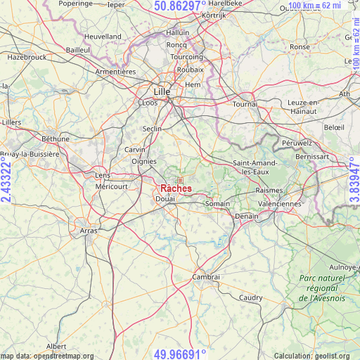
Râches GPS coordinates[2]
50° 25' 1.416" North, 3° 8' 10.86" East
| Map corner | latitude | longitude |
|---|---|---|
| Upper-left | 50.86297°, | 2.43322° |
| Center: | 50.41706°, | 3.13635° |
| Lower-right: | 49.96691°, | 3.83947° |
| Map W x H: | 99.6×99.6 km | = 61.9×61.9mi |
| max Lat: | 51.07786° ⇑3.4% North |
| Râches: | 50.41706° |
| min Lat: | ⇓96.6% South 41.3874° |
| min Long | Râches | max Long |
| -5.08615° | 3.13635° | 9.52242° |
| W 59.8%⇐ | ⇒40.2% E |
Elevation
Elevation of Râches is 23 m = 75 ft, and this is 170.7 m = 560 ft below average elevation for this country.
| Max E: |
2333 m = 7654 ft | 92.7% |
| Avg. | 193.7 m = 635 ft | |
| Râches | 23 m = 75 ft | |
Min E: |
-1 m = -3 ft | 7.3% |
See also: France elevation on elevation.city.
Geographical zone
Râches is located in North temperate zone (between Tropic of Cancer and the Arctic Circle). Distance of this North polar circle is 1795.3 km =1115.5 mi to North.| Distance of | km | miles | from Râches |
|---|---|---|---|
| North Pole | 4401.2 | 2734.8 | to North |
| Arctic Circle | 1795.3 | 1115.5 | to North |
| Tropic Cancer | 2999.9 | 1864.1 | to South |
| Equator | 5605.9 | 3483.3 | to South |


Nearby cities:
15 places around Râches: (largest is in red/bold)
• Anhiers
1.7 km =1.1 mi,  129°
129°
• Auby
5.8 km =3.6 mi,  267°
267°
• Coutiches
6.4 km =4 mi,  48°
48°
• Douai
6.6 km =4.1 mi,  218°
218°
• Faumont
4.8 km =3 mi,  0°
0°
• Flers-en-Escrebieux
5.8 km =3.6 mi,  248°
248°
• Flines-lez-Raches
3.3 km =2.1 mi,  90°
90°
• Lallaing
3.8 km =2.4 mi,  141°
141°
• Leforest
5.6 km =3.5 mi,  295°
295°
• Montigny-en-Ostrevent
6.5 km =4 mi,  149°
149°
• Pecquencourt
6.9 km =4.3 mi, 128°
• Raimbeaucourt
3.6 km =2.2 mi, 302°
• Roost-Warendin
2.3 km =1.4 mi,  275°
275°
• Sin-le-Noble
6.2 km =3.9 mi,  183°
183°
• Waziers
3.7 km =2.3 mi,  204°
204°
Sources, notices
• [Note1] Compared only with cities in France existing in our database
• [Src1] Map data: © OpenStreetMap contributors (CC-BY-SA)
• [Src2] Other city data from geonames.org with taken over terms of usage.
• [Src3] Geographical zone / Annual Mean Temperature by Robert A. Rohde @ Wikipedia
