Courtomer geodata
Courtomer (Île-de-France) is a populated place; located in France in Europe/Paris (GMT+2) time zone. With population of 613 people, there are 13109 cities with bigger population in this country. Compared to other cities in France, 72.1% of cities are located further ↓South; 56.5% of cities are located further ←West and 67% of cities have higher elevation than Courtomer. Note1
Administrative division(s):
- Level 1: Île-de-France
- Level 2: Seine-et-Marne
- Level 3: Arrondissement de Provins
- Level 4: Courtomer


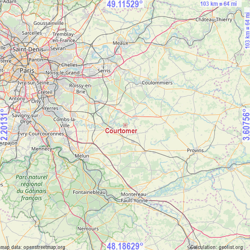
Courtomer GPS coordinates[2]
48° 39' 10.548" North, 2° 54' 15.948" East
| Map corner | latitude | longitude |
|---|---|---|
| Upper-left | 49.11529°, | 2.20131° |
| Center: | 48.65293°, | 2.90443° |
| Lower-right: | 48.18629°, | 3.60756° |
| Map W x H: | 103.3×103.3 km | = 64.2×64.2mi |
| max Lat: | 51.07786° ⇑27.9% North |
| Courtomer: | 48.65293° |
| min Lat: | ⇓72.1% South 41.3874° |
| min Long | Courtomer | max Long |
| -5.08615° | 2.90443° | 9.52242° |
| W 56.5%⇐ | ⇒43.5% E |
Elevation
Elevation of Courtomer is 85 m = 279 ft, and this is 108.7 m = 357 ft below average elevation for this country.
| Max E: |
2333 m = 7654 ft | 67% |
| Avg. | 193.7 m = 635 ft | |
| Courtomer | 85 m = 279 ft | |
Min E: |
-1 m = -3 ft | 33% |
See also: France elevation on elevation.city.
Geographical zone
Courtomer is located in North temperate zone (between Tropic of Cancer and the Arctic Circle). Distance of this North polar circle is 1991.5 km =1237.5 mi to North.| Distance of | km | miles | from Courtomer |
|---|---|---|---|
| North Pole | 4597.4 | 2856.7 | to North |
| Arctic Circle | 1991.5 | 1237.5 | to North |
| Tropic Cancer | 2803.8 | 1742.2 | to South |
| Equator | 5409.7 | 3361.4 | to South |


Nearby cities:
15 places around Courtomer: (largest is in red/bold)
• Aubepierre-Ozouer-le-Repos
2.7 km =1.7 mi,  215°
215°
• Bernay-Vilbert
3.6 km =2.2 mi,  42°
42°
• Bombon
9.6 km =6 mi,  199°
199°
• Chaumes-en-Brie
5 km =3.1 mi,  290°
290°
• Châtres
9.4 km =5.8 mi,  312°
312°
• Courpalay
4.2 km =2.6 mi,  95°
95°
• Fontenay-Trésigny
6.5 km =4 mi,  337°
337°
• Gastins
8.9 km =5.5 mi,  107°
107°
• Guignes
8 km =5 mi,  254°
254°
• Lumigny-Nesles-Ormeaux
9.5 km =5.9 mi,  20°
20°
• Marles-en-Brie
8.5 km =5.3 mi,  347°
347°
• Mormant
5 km =3.1 mi,  192°
192°
• Quiers
7 km =4.3 mi,  136°
136°
• Rozay-en-Brie
5.2 km =3.2 mi,  49°
49°
• Voinsles
8.5 km =5.3 mi,  59°
59°
Sources, notices
• [Note1] Compared only with cities in France existing in our database
• [Src1] Map data: © OpenStreetMap contributors (CC-BY-SA)
• [Src2] Other city data from geonames.org with taken over terms of usage.
• [Src3] Geographical zone / Annual Mean Temperature by Robert A. Rohde @ Wikipedia
