Guignes geodata
Guignes (Île-de-France) is a populated place; located in France in Europe/Paris (GMT+2) time zone. With population of 2,639 people, there are 3695 cities with bigger population in this country. Compared to other cities in France, 71.6% of cities are located further ↓South; 54.9% of cities are located further ←West and 63.6% of cities have higher elevation than Guignes. Note1
Administrative division(s):
- Level 1: Île-de-France
- Level 2: Seine-et-Marne
- Level 3: Arrondissement de Melun
- Level 4: Guignes


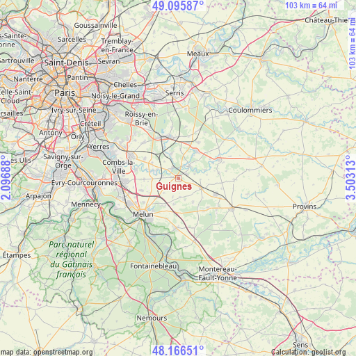
Guignes GPS coordinates[2]
48° 37' 59.988" North, 2° 48' 0" East
| Map corner | latitude | longitude |
|---|---|---|
| Upper-left | 49.09587°, | 2.09688° |
| Center: | 48.63333°, | 2.8° |
| Lower-right: | 48.16651°, | 3.50313° |
| Map W x H: | 103.3×103.3 km | = 64.2×64.2mi |
| max Lat: | 51.07786° ⇑28.4% North |
| Guignes: | 48.63333° |
| min Lat: | ⇓71.6% South 41.3874° |
| min Long | Guignes | max Long |
| -5.08615° | 2.8° | 9.52242° |
| W 54.9%⇐ | ⇒45.1% E |
Elevation
Elevation of Guignes is 93 m = 305 ft, and this is 100.7 m = 330 ft below average elevation for this country.
| Max E: |
2333 m = 7654 ft | 63.6% |
| Avg. | 193.7 m = 635 ft | |
| Guignes | 93 m = 305 ft | |
Min E: |
-1 m = -3 ft | 36.4% |
See also: France elevation on elevation.city.
Geographical zone
Guignes is located in North temperate zone (between Tropic of Cancer and the Arctic Circle). Distance of this North polar circle is 1993.7 km =1238.8 mi to North.| Distance of | km | miles | from Guignes |
|---|---|---|---|
| North Pole | 4599.5 | 2858 | to North |
| Arctic Circle | 1993.7 | 1238.8 | to North |
| Tropic Cancer | 2801.6 | 1740.8 | to South |
| Equator | 5407.5 | 3360.1 | to South |


Nearby cities:
15 places around Guignes: (largest is in red/bold)
• Aubepierre-Ozouer-le-Repos
6.1 km =3.8 mi,  90°
90°
• Blandy
7.5 km =4.7 mi,  190°
190°
• Bombon
8.2 km =5.1 mi,  146°
146°
• Champdeuil
5.4 km =3.4 mi,  255°
255°
• Champeaux
5.4 km =3.4 mi,  174°
174°
• Chaumes-en-Brie
4.9 km =3 mi,  36°
36°
• Courtomer
8 km =5 mi,  74°
74°
• Crisenoy
6 km =3.7 mi,  225°
225°
• Fouju
5.5 km =3.4 mi,  197°
197°
• Liverdy-en-Brie
7.6 km =4.7 mi,  346°
346°
• Mormant
7.2 km =4.5 mi,  112°
112°
• Ozouer-le-Voulgis
3.5 km =2.2 mi,  327°
327°
• Soignolles-en-Brie
7.7 km =4.8 mi,  286°
286°
• Solers
6.8 km =4.2 mi,  295°
295°
• Yèbles
2.4 km =1.5 mi,  278°
278°
Sources, notices
• [Note1] Compared only with cities in France existing in our database
• [Src1] Map data: © OpenStreetMap contributors (CC-BY-SA)
• [Src2] Other city data from geonames.org with taken over terms of usage.
• [Src3] Geographical zone / Annual Mean Temperature by Robert A. Rohde @ Wikipedia
