Bombon geodata
Bombon (Île-de-France) is a populated place; located in France in Europe/Paris (GMT+2) time zone. With population of 991 people, there are 8899 cities with bigger population in this country. Compared to other cities in France, 70.2% of cities are located further ↓South; 55.8% of cities are located further ←West and 59.1% of cities have higher elevation than Bombon. Note1
Administrative division(s):
- Level 1: Île-de-France
- Level 2: Seine-et-Marne
- Level 3: Arrondissement de Melun
- Level 4: Bombon


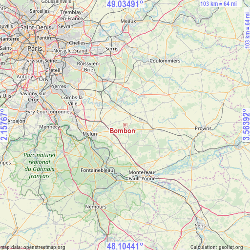
Bombon GPS coordinates[2]
48° 34' 18.48" North, 2° 51' 38.844" East
| Map corner | latitude | longitude |
|---|---|---|
| Upper-left | 49.03491°, | 2.15767° |
| Center: | 48.5718°, | 2.86079° |
| Lower-right: | 48.10441°, | 3.56392° |
| Map W x H: | 103.5×103.5 km | = 64.3×64.3mi |
| max Lat: | 51.07786° ⇑29.8% North |
| Bombon: | 48.5718° |
| min Lat: | ⇓70.2% South 41.3874° |
| min Long | Bombon | max Long |
| -5.08615° | 2.86079° | 9.52242° |
| W 55.8%⇐ | ⇒44.2% E |
Elevation
Elevation of Bombon is 105 m = 344 ft, and this is 88.7 m = 291 ft below average elevation for this country.
| Max E: |
2333 m = 7654 ft | 59.1% |
| Avg. | 193.7 m = 635 ft | |
| Bombon | 105 m = 344 ft | |
Min E: |
-1 m = -3 ft | 40.9% |
See also: France elevation on elevation.city.
Geographical zone
Bombon is located in North temperate zone (between Tropic of Cancer and the Arctic Circle). Distance of this North polar circle is 2000.5 km =1243.1 mi to North.| Distance of | km | miles | from Bombon |
|---|---|---|---|
| North Pole | 4606.4 | 2862.3 | to North |
| Arctic Circle | 2000.5 | 1243.1 | to North |
| Tropic Cancer | 2794.8 | 1736.6 | to South |
| Equator | 5400.7 | 3355.8 | to South |


Nearby cities:
15 places around Bombon: (largest is in red/bold)
• Aubepierre-Ozouer-le-Repos
7 km =4.3 mi,  13°
13°
• Blandy
5.8 km =3.6 mi,  264°
264°
• Champeaux
4.2 km =2.6 mi,  289°
289°
• Crisenoy
9.1 km =5.7 mi, 286°
• Fontenailles
7.1 km =4.4 mi,  107°
107°
• Fouju
6.3 km =3.9 mi,  284°
284°
• Guignes
8.2 km =5.1 mi,  326°
326°
• La Chapelle-Gauthier
3.7 km =2.3 mi,  132°
132°
• Le Châtelet-en-Brie
8.8 km =5.5 mi,  215°
215°
• Les Écrennes
7.5 km =4.7 mi,  181°
181°
• Moisenay
9.3 km =5.8 mi, 263°
• Mormant
4.7 km =2.9 mi,  27°
27°
• Quiers
8.9 km =5.5 mi,  63°
63°
• Saint-Ouen-en-Brie
4.6 km =2.9 mi, 109°
• Sivry-Courtry
9.2 km =5.7 mi,  238°
238°
Sources, notices
• [Note1] Compared only with cities in France existing in our database
• [Src1] Map data: © OpenStreetMap contributors (CC-BY-SA)
• [Src2] Other city data from geonames.org with taken over terms of usage.
• [Src3] Geographical zone / Annual Mean Temperature by Robert A. Rohde @ Wikipedia
