Courdemanche geodata
Courdemanche (Normandy) is a populated place; located in France in Europe/Paris (GMT+2) time zone. With population of 503 people, there are 15179 cities with bigger population in this country. Compared to other cities in France, 75.9% of cities are located further ↓South; 65.8% of cities are located further →East and 51.1% of cities have lower elevation than Courdemanche. Note1
Administrative division(s):
- Level 1: Normandy
- Level 2: Département de l'Eure
- Level 3: Arrondissement d’Évreux
- Level 4: Courdemanche


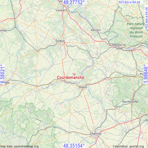
Courdemanche GPS coordinates[2]
48° 49' 0.012" North, 1° 16' 59.988" East
| Map corner | latitude | longitude |
|---|---|---|
| Upper-left | 49.27752°, | 0.58021° |
| Center: | 48.81667°, | 1.28333° |
| Lower-right: | 48.35154°, | 1.98646° |
| Map W x H: | 103×103 km | = 64×64mi |
| max Lat: | 51.07786° ⇑24.1% North |
| Courdemanche: | 48.81667° |
| min Lat: | ⇓75.9% South 41.3874° |
| min Long | Courdemanche | max Long |
| -5.08615° | 1.28333° | 9.52242° |
| W 34.2%⇐ | ⇒65.8% E |
Elevation
Elevation of Courdemanche is 136 m = 446 ft, and this is 57.7 m = 189 ft below average elevation for this country.
| Max E: |
2333 m = 7654 ft | 48.9% |
| Avg. | 193.7 m = 635 ft | |
| Courdemanche | 136 m = 446 ft | |
Min E: |
-1 m = -3 ft | 51.1% |
See also: France elevation on elevation.city.
Geographical zone
Courdemanche is located in North temperate zone (between Tropic of Cancer and the Arctic Circle). Distance of this North polar circle is 1973.3 km =1226.2 mi to North.| Distance of | km | miles | from Courdemanche |
|---|---|---|---|
| North Pole | 4579.2 | 2845.4 | to North |
| Arctic Circle | 1973.3 | 1226.2 | to North |
| Tropic Cancer | 2822 | 1753.5 | to South |
| Equator | 5427.9 | 3372.7 | to South |


Nearby cities:
15 places around Courdemanche: (largest is in red/bold)
• Bois-le-Roi
6.7 km =4.2 mi,  40°
40°
• Croth
7.7 km =4.8 mi,  65°
65°
• La Madeleine-de-Nonancourt
7.7 km =4.8 mi,  230°
230°
• Marcilly-la-Campagne
6.3 km =3.9 mi,  287°
287°
• Marcilly-sur-Eure
4.8 km =3 mi,  77°
77°
• Mesnil-sur-l’Estrée
5.3 km =3.3 mi,  165°
165°
• Montreuil
7.7 km =4.8 mi,  124°
124°
• Muzy
6.7 km =4.2 mi,  135°
135°
• Nonancourt
8.1 km =5 mi, 230°
• Saint-Georges-Motel
6.6 km =4.1 mi,  113°
113°
• Saint-Germain-sur-Avre
5.9 km =3.7 mi,  191°
191°
• Saint-Lubin-des-Joncherets
7.4 km =4.6 mi,  221°
221°
• Saint-Rémy-sur-Avre
6.7 km =4.2 mi,  204°
204°
• Sorel-Moussel
6.4 km =4 mi, 72°
• Vert-en-Drouais
6.3 km =3.9 mi, 172°
Sources, notices
• [Note1] Compared only with cities in France existing in our database
• [Src1] Map data: © OpenStreetMap contributors (CC-BY-SA)
• [Src2] Other city data from geonames.org with taken over terms of usage.
• [Src3] Geographical zone / Annual Mean Temperature by Robert A. Rohde @ Wikipedia
