Saint-Lubin-des-Joncherets geodata
Saint-Lubin-des-Joncherets (Centre) is a populated place; located in France in Europe/Paris (GMT+2) time zone. With population of 4,513 people, there are 2185 cities with bigger population in this country. Compared to other cities in France, 74.8% of cities are located further ↓South; 66.5% of cities are located further →East and 50.5% of cities have higher elevation than Saint-Lubin-des-Joncherets. Note1
Administrative division(s):
- Level 1: Centre
- Level 2: Département d'Eure-et-Loir
- Level 3: Arrondissement de Dreux
- Level 4: Saint-Lubin-des-Joncherets
Current local time in Saint-Lubin-des-Joncherets:
12:45 PM, SaturdayDifference from your time zone: hours


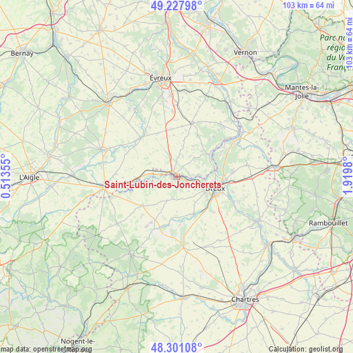
Saint-Lubin-des-Joncherets GPS coordinates[2]
48° 46' 0.012" North, 1° 13' 0.012" East
| Map corner | latitude | longitude |
|---|---|---|
| Upper-left | 49.22798°, | 0.51355° |
| Center: | 48.76667°, | 1.21667° |
| Lower-right: | 48.30108°, | 1.9198° |
| Map W x H: | 103.1×103.1 km | = 64.1×64.1mi |
| max Lat: | 51.07786° ⇑25.2% North |
| Saint-Lubin-des-Joncherets: | 48.76667° |
| min Lat: | ⇓74.8% South 41.3874° |
| min Long | Saint-Lubin-des | max Long |
| -5.08615° | 1.21667° | 9.52242° |
| W 33.5%⇐ | ⇒66.5% E |
Elevation
Elevation of Saint-Lubin-des-Joncherets is 130 m = 427 ft, and this is 63.7 m = 209 ft below average elevation for this country.
| Max E: |
2333 m = 7654 ft | 50.5% |
| Avg. | 193.7 m = 635 ft | |
| Saint-Lubin-des-Joncherets | 130 m = 427 ft | |
Min E: |
-1 m = -3 ft | 49.5% |
See also: France elevation on elevation.city.
Geographical zone
Saint-Lubin-des-Joncherets is located in North temperate zone (between Tropic of Cancer and the Arctic Circle). Distance of this North polar circle is 1978.8 km =1229.6 mi to North.| Distance of | km | miles | from Saint-Lubin-des-Joncherets |
|---|---|---|---|
| North Pole | 4584.7 | 2848.8 | to North |
| Arctic Circle | 1978.8 | 1229.6 | to North |
| Tropic Cancer | 2816.4 | 1750 | to South |
| Equator | 5422.3 | 3369.3 | to South |


Nearby cities:
15 places around Saint-Lubin-des-Joncherets: (largest is in red/bold)
• Courdemanche
7.4 km =4.6 mi,  41°
41°
• Dampierre-sur-Avre
5 km =3.1 mi,  264°
264°
• Dreux
11.4 km =7.1 mi,  107°
107°
• Garnay
11.2 km =7 mi,  127°
127°
• La Madeleine-de-Nonancourt
1.3 km =0.8 mi,  304°
304°
• Laons
7.5 km =4.7 mi,  203°
203°
• Marcilly-la-Campagne
7.5 km =4.7 mi,  351°
351°
• Mesnil-sur-l’Estrée
6.2 km =3.9 mi,  86°
86°
• Montreuil
11.3 km =7 mi,  83°
83°
• Muzy
9.6 km =6 mi, 85°
• Nonancourt
1.4 km =0.9 mi,  288°
288°
• Saint-Georges-Motel
11.3 km =7 mi,  74°
74°
• Saint-Germain-sur-Avre
3.8 km =2.4 mi, 93°
• Saint-Rémy-sur-Avre
2.2 km =1.4 mi, 105°
• Vert-en-Drouais
5.8 km =3.6 mi,  97°
97°
Sources, notices
• [Note1] Compared only with cities in France existing in our database
• [Src1] Map data: © OpenStreetMap contributors (CC-BY-SA)
• [Src2] Other city data from geonames.org with taken over terms of usage.
• [Src3] Geographical zone / Annual Mean Temperature by Robert A. Rohde @ Wikipedia
