Vert-en-Drouais geodata
Vert-en-Drouais (Centre) is a populated place; located in France in Europe/Paris (GMT+2) time zone. With population of 1,076 people, there are 8284 cities with bigger population in this country. Compared to other cities in France, 74.6% of cities are located further ↓South; 65.6% of cities are located further →East and 64.4% of cities have higher elevation than Vert-en-Drouais. Note1
Administrative division(s):
- Level 1: Centre
- Level 2: Département d'Eure-et-Loir
- Level 3: Arrondissement de Dreux
- Level 4: Vert-en-Drouais


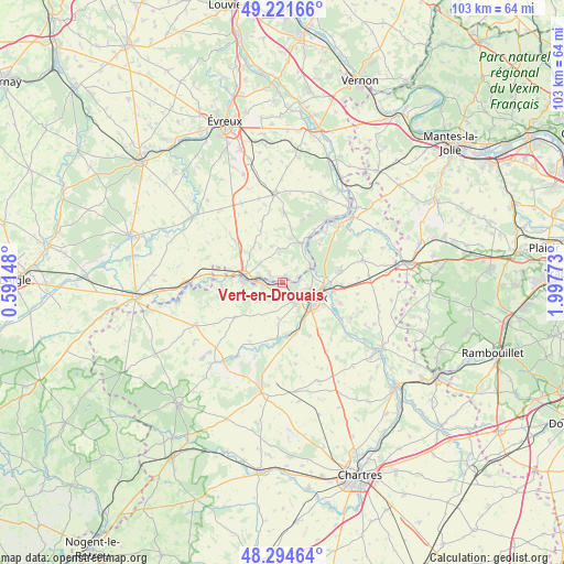
Vert-en-Drouais GPS coordinates[2]
48° 45' 37.044" North, 1° 17' 40.56" East
| Map corner | latitude | longitude |
|---|---|---|
| Upper-left | 49.22166°, | 0.59148° |
| Center: | 48.76029°, | 1.2946° |
| Lower-right: | 48.29464°, | 1.99773° |
| Map W x H: | 103.1×103.1 km | = 64.1×64.1mi |
| max Lat: | 51.07786° ⇑25.4% North |
| Vert-en-Drouais: | 48.76029° |
| min Lat: | ⇓74.6% South 41.3874° |
| min Long | Vert-en-Drouais | max Long |
| -5.08615° | 1.2946° | 9.52242° |
| W 34.4%⇐ | ⇒65.6% E |
Elevation
Elevation of Vert-en-Drouais is 91 m = 299 ft, and this is 102.7 m = 337 ft below average elevation for this country.
| Max E: |
2333 m = 7654 ft | 64.4% |
| Avg. | 193.7 m = 635 ft | |
| Vert-en-Drouais | 91 m = 299 ft | |
Min E: |
-1 m = -3 ft | 35.6% |
See also: France elevation on elevation.city.
Geographical zone
Vert-en-Drouais is located in North temperate zone (between Tropic of Cancer and the Arctic Circle). Distance of this North polar circle is 1979.5 km =1230 mi to North.| Distance of | km | miles | from Vert-en-Drouais |
|---|---|---|---|
| North Pole | 4585.4 | 2849.2 | to North |
| Arctic Circle | 1979.5 | 1230 | to North |
| Tropic Cancer | 2815.7 | 1749.6 | to South |
| Equator | 5421.6 | 3368.8 | to South |


Nearby cities:
15 places around Vert-en-Drouais: (largest is in red/bold)
• Courdemanche
6.3 km =3.9 mi,  352°
352°
• Dreux
5.8 km =3.6 mi,  116°
116°
• Garnay
6.9 km =4.3 mi,  153°
153°
• La Madeleine-de-Nonancourt
6.9 km =4.3 mi,  281°
281°
• Luray
8.8 km =5.5 mi, 120°
• Marcilly-sur-Eure
8.2 km =5.1 mi,  28°
28°
• Mesnil-sur-l’Estrée
1.2 km =0.7 mi,  23°
23°
• Montreuil
5.8 km =3.6 mi,  70°
70°
• Muzy
4.2 km =2.6 mi, 68°
• Nonancourt
7.2 km =4.5 mi, 279°
• Saint-Georges-Motel
6.4 km =4 mi,  54°
54°
• Saint-Germain-sur-Avre
2 km =1.2 mi, 283°
• Saint-Lubin-des-Joncherets
5.8 km =3.6 mi, 277°
• Saint-Rémy-sur-Avre
3.6 km =2.2 mi,  272°
272°
• Vernouillet
7 km =4.3 mi,  128°
128°
Sources, notices
• [Note1] Compared only with cities in France existing in our database
• [Src1] Map data: © OpenStreetMap contributors (CC-BY-SA)
• [Src2] Other city data from geonames.org with taken over terms of usage.
• [Src3] Geographical zone / Annual Mean Temperature by Robert A. Rohde @ Wikipedia
