Courcouronnes geodata
Courcouronnes (Île-de-France) is a populated place; located in France in Europe/Paris (GMT+2) time zone. With population of 14,856 people, there are 642 cities with bigger population in this country. Compared to other cities in France, 71.2% of cities are located further ↓South; 51% of cities are located further →East and 69.2% of cities have higher elevation than Courcouronnes. Note1
Administrative division(s):
- Level 1: Île-de-France
- Level 2: Département de l'Essonne
- Level 3: Arrondissement d'Évry
- Level 4: Évry-Courcouronnes


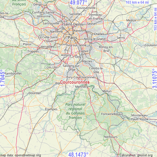
Courcouronnes GPS coordinates[2]
48° 36' 51.444" North, 2° 24' 27.432" East
| Map corner | latitude | longitude |
|---|---|---|
| Upper-left | 49.077°, | 1.7045° |
| Center: | 48.61429°, | 2.40762° |
| Lower-right: | 48.1473°, | 3.11075° |
| Map W x H: | 103.4×103.4 km | = 64.2×64.2mi |
| max Lat: | 51.07786° ⇑28.8% North |
| Courcouronnes: | 48.61429° |
| min Lat: | ⇓71.2% South 41.3874° |
| min Long | Courcouronnes | max Long |
| -5.08615° | 2.40762° | 9.52242° |
| W 49%⇐ | ⇒51% E |
Elevation
Elevation of Courcouronnes is 80 m = 262 ft, and this is 113.7 m = 373 ft below average elevation for this country.
| Max E: |
2333 m = 7654 ft | 69.2% |
| Avg. | 193.7 m = 635 ft | |
| Courcouronnes | 80 m = 262 ft | |
Min E: |
-1 m = -3 ft | 30.8% |
See also: France elevation on elevation.city.
Geographical zone
Courcouronnes is located in North temperate zone (between Tropic of Cancer and the Arctic Circle). Distance of this North polar circle is 1995.8 km =1240.1 mi to North.| Distance of | km | miles | from Courcouronnes |
|---|---|---|---|
| North Pole | 4601.7 | 2859.4 | to North |
| Arctic Circle | 1995.8 | 1240.1 | to North |
| Tropic Cancer | 2799.5 | 1739.5 | to South |
| Equator | 5405.4 | 3358.8 | to South |


Nearby cities:
15 places around Courcouronnes: (largest is in red/bold)
• Bondoufle
2.2 km =1.4 mi,  266°
266°
• Corbeil-Essonnes
5.9 km =3.7 mi,  98°
98°
• Fleury-Mérogis
4.1 km =2.5 mi,  308°
308°
• Grigny
4.5 km =2.8 mi,  346°
346°
• Lisses
1.7 km =1.1 mi,  140°
140°
• Mennecy
5.7 km =3.5 mi,  152°
152°
• Ormoy
5.5 km =3.4 mi, 143°
• Ris-Orangis
4.1 km =2.5 mi,  6°
6°
• Saint-Germain-lès-Corbeil
6 km =3.7 mi,  81°
81°
• Soisy-sur-Seine
5 km =3.1 mi,  40°
40°
• Vert-le-Grand
6 km =3.7 mi,  217°
217°
• Villabé
4.2 km =2.6 mi,  130°
130°
• Écharcon
4.6 km =2.9 mi,  177°
177°
• Étiolles
5.8 km =3.6 mi,  69°
69°
• Évry
3.2 km =2 mi,  49°
49°
Sources, notices
• [Note1] Compared only with cities in France existing in our database
• [Src1] Map data: © OpenStreetMap contributors (CC-BY-SA)
• [Src2] Other city data from geonames.org with taken over terms of usage.
• [Src3] Geographical zone / Annual Mean Temperature by Robert A. Rohde @ Wikipedia
