Mennecy geodata
Mennecy (Île-de-France) is a populated place; located in France in Europe/Paris (GMT+2) time zone. With population of 14,646 people, there are 653 cities with bigger population in this country. Compared to other cities in France, 70.1% of cities are located further ↓South; 50.3% of cities are located further →East and 68.3% of cities have higher elevation than Mennecy. Note1
Administrative division(s):
- Level 1: Île-de-France
- Level 2: Département de l'Essonne
- Level 3: Arrondissement d'Évry
- Level 4: Mennecy


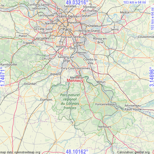
Mennecy GPS coordinates[2]
48° 34' 8.508" North, 2° 26' 37.824" East
| Map corner | latitude | longitude |
|---|---|---|
| Upper-left | 49.03216°, | 1.74071° |
| Center: | 48.56903°, | 2.44384° |
| Lower-right: | 48.10162°, | 3.14696° |
| Map W x H: | 103.5×103.5 km | = 64.3×64.3mi |
| max Lat: | 51.07786° ⇑29.9% North |
| Mennecy: | 48.56903° |
| min Lat: | ⇓70.1% South 41.3874° |
| min Long | Mennecy | max Long |
| -5.08615° | 2.44384° | 9.52242° |
| W 49.7%⇐ | ⇒50.3% E |
Elevation
Elevation of Mennecy is 82 m = 269 ft, and this is 111.7 m = 366 ft below average elevation for this country.
| Max E: |
2333 m = 7654 ft | 68.3% |
| Avg. | 193.7 m = 635 ft | |
| Mennecy | 82 m = 269 ft | |
Min E: |
-1 m = -3 ft | 31.7% |
See also: France elevation on elevation.city.
Geographical zone
Mennecy is located in North temperate zone (between Tropic of Cancer and the Arctic Circle). Distance of this North polar circle is 2000.8 km =1243.2 mi to North.| Distance of | km | miles | from Mennecy |
|---|---|---|---|
| North Pole | 4606.7 | 2862.5 | to North |
| Arctic Circle | 2000.8 | 1243.2 | to North |
| Tropic Cancer | 2794.5 | 1736.4 | to South |
| Equator | 5400.4 | 3355.7 | to South |


Nearby cities:
15 places around Mennecy: (largest is in red/bold)
• Champcueil
5.9 km =3.7 mi,  177°
177°
• Chevannes
4.1 km =2.5 mi, 179°
• Corbeil-Essonnes
5.2 km =3.2 mi,  38°
38°
• Courcouronnes
5.7 km =3.5 mi,  332°
332°
• Fontenay-le-Vicomte
4.1 km =2.5 mi,  234°
234°
• Le Coudray-Montceaux
4.2 km =2.6 mi,  98°
98°
• Lisses
4 km =2.5 mi,  336°
336°
• Ormoy
0.9 km =0.6 mi, 42°
• Saint-Fargeau-Ponthierry
6.4 km =4 mi, 102°
• Saint-Pierre-du-Perray
5.9 km =3.7 mi, 38°
• Saintry-sur-Seine
4.8 km =3 mi,  51°
51°
• Vert-le-Grand
6.3 km =3.9 mi,  272°
272°
• Vert-le-Petit
6.1 km =3.8 mi,  251°
251°
• Villabé
2.3 km =1.4 mi,  12°
12°
• Écharcon
2.5 km =1.6 mi,  281°
281°
Sources, notices
• [Note1] Compared only with cities in France existing in our database
• [Src1] Map data: © OpenStreetMap contributors (CC-BY-SA)
• [Src2] Other city data from geonames.org with taken over terms of usage.
• [Src3] Geographical zone / Annual Mean Temperature by Robert A. Rohde @ Wikipedia
