Soisy-sur-Seine geodata
Soisy-sur-Seine (Île-de-France) is a populated place; located in France in Europe/Paris (GMT+2) time zone. With population of 7,552 people, there are 1290 cities with bigger population in this country. Compared to other cities in France, 72% of cities are located further ↓South; 50.1% of cities are located further →East and 78.2% of cities have higher elevation than Soisy-sur-Seine. Note1
Administrative division(s):
- Level 1: Île-de-France
- Level 2: Département de l'Essonne
- Level 3: Arrondissement d'Évry
- Level 4: Soisy-sur-Seine


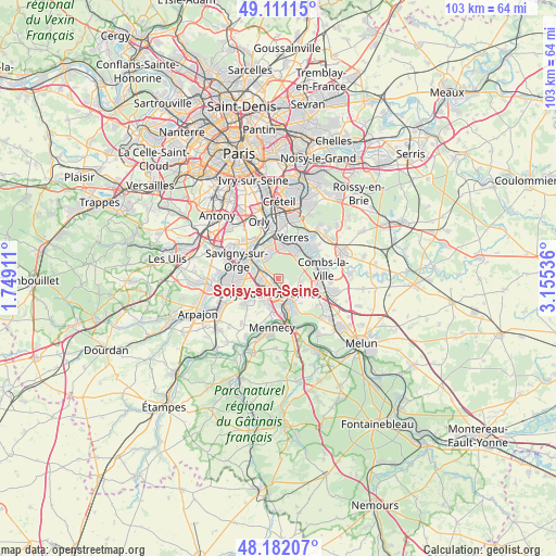
Soisy-sur-Seine GPS coordinates[2]
48° 38' 55.5" North, 2° 27' 8.028" East
| Map corner | latitude | longitude |
|---|---|---|
| Upper-left | 49.11115°, | 1.74911° |
| Center: | 48.64875°, | 2.45223° |
| Lower-right: | 48.18207°, | 3.15536° |
| Map W x H: | 103.3×103.3 km | = 64.2×64.2mi |
| max Lat: | 51.07786° ⇑28% North |
| Soisy-sur-Seine: | 48.64875° |
| min Lat: | ⇓72% South 41.3874° |
| min Long | Soisy-sur-Seine | max Long |
| -5.08615° | 2.45223° | 9.52242° |
| W 49.9%⇐ | ⇒50.1% E |
Elevation
Elevation of Soisy-sur-Seine is 59 m = 194 ft, and this is 134.7 m = 442 ft below average elevation for this country.
| Max E: |
2333 m = 7654 ft | 78.2% |
| Avg. | 193.7 m = 635 ft | |
| Soisy-sur-Seine | 59 m = 194 ft | |
Min E: |
-1 m = -3 ft | 21.8% |
See also: France elevation on elevation.city.
Geographical zone
Soisy-sur-Seine is located in North temperate zone (between Tropic of Cancer and the Arctic Circle). Distance of this North polar circle is 1991.9 km =1237.7 mi to North.| Distance of | km | miles | from Soisy-sur-Seine |
|---|---|---|---|
| North Pole | 4597.8 | 2856.9 | to North |
| Arctic Circle | 1991.9 | 1237.7 | to North |
| Tropic Cancer | 2803.3 | 1741.9 | to South |
| Equator | 5409.2 | 3361.1 | to South |


Nearby cities:
15 places around Soisy-sur-Seine: (largest is in red/bold)
• Brunoy
5.8 km =3.6 mi,  30°
30°
• Corbeil-Essonnes
5.4 km =3.4 mi,  151°
151°
• Courcouronnes
5 km =3.1 mi,  220°
220°
• Draveil
4.9 km =3 mi,  325°
325°
• Grigny
4.4 km =2.7 mi,  277°
277°
• Lisses
5.6 km =3.5 mi,  202°
202°
• Montgeron
6.3 km =3.9 mi,  358°
358°
• Ris-Orangis
2.8 km =1.7 mi, 275°
• Saint-Germain-lès-Corbeil
3.9 km =2.4 mi,  138°
138°
• Saint-Pierre-du-Perray
5.2 km =3.2 mi, 143°
• Tigery
4.1 km =2.5 mi,  99°
99°
• Viry-Châtillon
5.1 km =3.2 mi,  300°
300°
• Épinay-sous-Sénart
6.3 km =3.9 mi,  43°
43°
• Étiolles
2.9 km =1.8 mi,  129°
129°
• Évry
2 km =1.2 mi,  205°
205°
Sources, notices
• [Note1] Compared only with cities in France existing in our database
• [Src1] Map data: © OpenStreetMap contributors (CC-BY-SA)
• [Src2] Other city data from geonames.org with taken over terms of usage.
• [Src3] Geographical zone / Annual Mean Temperature by Robert A. Rohde @ Wikipedia
