Vert-le-Grand geodata
Vert-le-Grand (Île-de-France) is a populated place; located in France in Europe/Paris (GMT+2) time zone. With population of 2,014 people, there are 4765 cities with bigger population in this country. Compared to other cities in France, 70.2% of cities are located further ↓South; 51.7% of cities are located further →East and 73.6% of cities have higher elevation than Vert-le-Grand. Note1
Administrative division(s):
- Level 1: Île-de-France
- Level 2: Département de l'Essonne
- Level 3: Arrondissement d'Évry
- Level 4: Vert-le-Grand


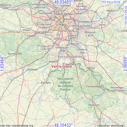
Vert-le-Grand GPS coordinates[2]
48° 34' 18.192" North, 2° 21' 27.972" East
| Map corner | latitude | longitude |
|---|---|---|
| Upper-left | 49.03483°, | 1.65464° |
| Center: | 48.57172°, | 2.35777° |
| Lower-right: | 48.10433°, | 3.06089° |
| Map W x H: | 103.5×103.5 km | = 64.3×64.3mi |
| max Lat: | 51.07786° ⇑29.8% North |
| Vert-le-Grand: | 48.57172° |
| min Lat: | ⇓70.2% South 41.3874° |
| min Long | Vert-le-Grand | max Long |
| -5.08615° | 2.35777° | 9.52242° |
| W 48.3%⇐ | ⇒51.7% E |
Elevation
Elevation of Vert-le-Grand is 70 m = 230 ft, and this is 123.7 m = 406 ft below average elevation for this country.
| Max E: |
2333 m = 7654 ft | 73.6% |
| Avg. | 193.7 m = 635 ft | |
| Vert-le-Grand | 70 m = 230 ft | |
Min E: |
-1 m = -3 ft | 26.4% |
See also: France elevation on elevation.city.
Geographical zone
Vert-le-Grand is located in North temperate zone (between Tropic of Cancer and the Arctic Circle). Distance of this North polar circle is 2000.5 km =1243.1 mi to North.| Distance of | km | miles | from Vert-le-Grand |
|---|---|---|---|
| North Pole | 4606.4 | 2862.3 | to North |
| Arctic Circle | 2000.5 | 1243.1 | to North |
| Tropic Cancer | 2794.8 | 1736.6 | to South |
| Equator | 5400.7 | 3355.8 | to South |


Nearby cities:
15 places around Vert-le-Grand: (largest is in red/bold)
• Ballancourt-sur-Essonne
5.6 km =3.5 mi,  158°
158°
• Bondoufle
4.8 km =3 mi,  17°
17°
• Brétigny-sur-Orge
5.8 km =3.6 mi,  319°
319°
• Cheptainville
6.4 km =4 mi,  248°
248°
• Courcouronnes
6 km =3.7 mi,  37°
37°
• Fontenay-le-Vicomte
4 km =2.5 mi,  131°
131°
• Itteville
6.4 km =4 mi,  189°
189°
• Le Plessis-Pâté
5 km =3.1 mi,  329°
329°
• Leudeville
2.4 km =1.5 mi, 254°
• Lisses
5.8 km =3.6 mi,  54°
54°
• Marolles-en-Hurepoix
4.5 km =2.8 mi,  256°
256°
• Mennecy
6.3 km =3.9 mi,  92°
92°
• Saint-Vrain
3.7 km =2.3 mi,  209°
209°
• Vert-le-Petit
2.3 km =1.4 mi,  166°
166°
• Écharcon
3.9 km =2.4 mi, 87°
Sources, notices
• [Note1] Compared only with cities in France existing in our database
• [Src1] Map data: © OpenStreetMap contributors (CC-BY-SA)
• [Src2] Other city data from geonames.org with taken over terms of usage.
• [Src3] Geographical zone / Annual Mean Temperature by Robert A. Rohde @ Wikipedia
