Corquilleroy geodata
Corquilleroy (Centre) is a populated place; located in France in Europe/Paris (GMT+2) time zone. With population of 2,272 people, there are 4238 cities with bigger population in this country. Compared to other cities in France, 60.1% of cities are located further ↓South; 53.5% of cities are located further ←West and 65.3% of cities have higher elevation than Corquilleroy. Note1
Administrative division(s):
- Level 1: Centre
- Level 2: Loiret
- Level 3: Arrondissement de Montargis
- Level 4: Corquilleroy


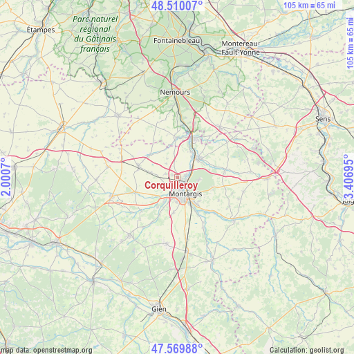
Corquilleroy GPS coordinates[2]
48° 2' 31.632" North, 2° 42' 13.752" East
| Map corner | latitude | longitude |
|---|---|---|
| Upper-left | 48.51007°, | 2.0007° |
| Center: | 48.04212°, | 2.70382° |
| Lower-right: | 47.56988°, | 3.40695° |
| Map W x H: | 104.5×104.5 km | = 64.9×64.9mi |
| max Lat: | 51.07786° ⇑39.9% North |
| Corquilleroy: | 48.04212° |
| min Lat: | ⇓60.1% South 41.3874° |
| min Long | Corquilleroy | max Long |
| -5.08615° | 2.70382° | 9.52242° |
| W 53.5%⇐ | ⇒46.5% E |
Elevation
Elevation of Corquilleroy is 89 m = 292 ft, and this is 104.7 m = 344 ft below average elevation for this country.
| Max E: |
2333 m = 7654 ft | 65.3% |
| Avg. | 193.7 m = 635 ft | |
| Corquilleroy | 89 m = 292 ft | |
Min E: |
-1 m = -3 ft | 34.7% |
See also: France elevation on elevation.city.
Geographical zone
Corquilleroy is located in North temperate zone (between Tropic of Cancer and the Arctic Circle). Distance of this North polar circle is 2059.4 km =1279.7 mi to North.| Distance of | km | miles | from Corquilleroy |
|---|---|---|---|
| North Pole | 4665.3 | 2898.9 | to North |
| Arctic Circle | 2059.4 | 1279.7 | to North |
| Tropic Cancer | 2735.9 | 1700 | to South |
| Equator | 5341.8 | 3319.2 | to South |


Nearby cities:
15 places around Corquilleroy: (largest is in red/bold)
• Amilly
9.2 km =5.7 mi,  146°
146°
• Cepoy
2.6 km =1.6 mi,  75°
75°
• Chevillon-sur-Huillard
10.6 km =6.6 mi,  213°
213°
• Châlette-sur-Loing
4 km =2.5 mi,  143°
143°
• Fontenay-sur-Loing
8.7 km =5.4 mi,  37°
37°
• Girolles
2.3 km =1.4 mi,  21°
21°
• Griselles
10.4 km =6.5 mi,  63°
63°
• Montargis
5.5 km =3.4 mi,  156°
156°
• Nargis
8.6 km =5.3 mi,  26°
26°
• Pannes
3.7 km =2.3 mi,  226°
226°
• Paucourt
6.8 km =4.2 mi,  94°
94°
• Saint-Maurice-sur-Fessard
8.3 km =5.2 mi, 227°
• Sceaux-du-Gâtinais
10.7 km =6.6 mi,  311°
311°
• Villemandeur
6.2 km =3.9 mi,  170°
170°
• Vimory
10.6 km =6.6 mi,  186°
186°
Sources, notices
• [Note1] Compared only with cities in France existing in our database
• [Src1] Map data: © OpenStreetMap contributors (CC-BY-SA)
• [Src2] Other city data from geonames.org with taken over terms of usage.
• [Src3] Geographical zone / Annual Mean Temperature by Robert A. Rohde @ Wikipedia
