Cepoy geodata
Cepoy (Centre) is a populated place; located in France in Europe/Paris (GMT+2) time zone. With population of 2,236 people, there are 4300 cities with bigger population in this country. Compared to other cities in France, 60.2% of cities are located further ↓South; 54% of cities are located further ←West and 63.2% of cities have higher elevation than Cepoy. Note1
Administrative division(s):
- Level 1: Centre
- Level 2: Loiret
- Level 3: Arrondissement de Montargis
- Level 4: Cepoy


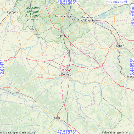
Cepoy GPS coordinates[2]
48° 2' 52.62" North, 2° 44' 16.152" East
| Map corner | latitude | longitude |
|---|---|---|
| Upper-left | 48.51585°, | 2.0347° |
| Center: | 48.04795°, | 2.73782° |
| Lower-right: | 47.57576°, | 3.44095° |
| Map W x H: | 104.5×104.5 km | = 64.9×64.9mi |
| max Lat: | 51.07786° ⇑39.8% North |
| Cepoy: | 48.04795° |
| min Lat: | ⇓60.2% South 41.3874° |
| min Long | Cepoy | max Long |
| -5.08615° | 2.73782° | 9.52242° |
| W 54%⇐ | ⇒46% E |
Elevation
Elevation of Cepoy is 94 m = 308 ft, and this is 99.7 m = 327 ft below average elevation for this country.
| Max E: |
2333 m = 7654 ft | 63.2% |
| Avg. | 193.7 m = 635 ft | |
| Cepoy | 94 m = 308 ft | |
Min E: |
-1 m = -3 ft | 36.8% |
See also: France elevation on elevation.city.
Geographical zone
Cepoy is located in North temperate zone (between Tropic of Cancer and the Arctic Circle). Distance of this North polar circle is 2058.7 km =1279.2 mi to North.| Distance of | km | miles | from Cepoy |
|---|---|---|---|
| North Pole | 4664.6 | 2898.4 | to North |
| Arctic Circle | 2058.7 | 1279.2 | to North |
| Tropic Cancer | 2736.5 | 1700.4 | to South |
| Equator | 5342.4 | 3319.6 | to South |


Nearby cities:
15 places around Cepoy: (largest is in red/bold)
• Amilly
8.7 km =5.4 mi,  163°
163°
• Châlette-sur-Loing
3.8 km =2.4 mi,  182°
182°
• Château-Landon
11.4 km =7.1 mi,  344°
344°
• Corquilleroy
2.6 km =1.6 mi,  255°
255°
• Dordives
10.7 km =6.6 mi,  11°
11°
• Fontenay-sur-Loing
6.8 km =4.2 mi,  24°
24°
• Girolles
2.2 km =1.4 mi,  311°
311°
• Griselles
7.9 km =4.9 mi,  60°
60°
• Montargis
5.7 km =3.5 mi, 183°
• Nargis
7.1 km =4.4 mi, 10°
• Pannes
6.1 km =3.8 mi,  238°
238°
• Paucourt
4.4 km =2.7 mi,  104°
104°
• Saint-Maurice-sur-Fessard
10.6 km =6.6 mi,  234°
234°
• Villemandeur
6.9 km =4.3 mi,  192°
192°
• Vimory
11.8 km =7.3 mi,  198°
198°
Sources, notices
• [Note1] Compared only with cities in France existing in our database
• [Src1] Map data: © OpenStreetMap contributors (CC-BY-SA)
• [Src2] Other city data from geonames.org with taken over terms of usage.
• [Src3] Geographical zone / Annual Mean Temperature by Robert A. Rohde @ Wikipedia
